File:נווה צדק - השכונה האדומה.jpg

Size of this preview: 548 × 599 pixels. Other resolutions: 219 × 240 pixels | 439 × 480 pixels | 702 × 768 pixels | 936 × 1,024 pixels | 1,872 × 2,048 pixels | 3,746 × 4,097 pixels.
Original file (3,746 × 4,097 pixels, file size: 9.85 MB, MIME type: image/jpeg)
Captions
Captions
Add a one-line explanation of what this file represents
Summary edit
| Description |
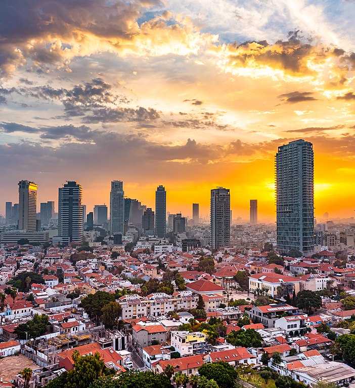
עברית: השכונה היהודית הרשמית הראשונה מחוץ לתוואי חומות העיר יפו. השכונה נוסדה ב-1887, כמה שנים לאחר שחומות יפו נהרסו.
|
||
| Date | |||
| Source | Own work | ||
| Author | Giladtop |
| Camera location | | View this and other nearby images on: OpenStreetMap |
|---|
Licensing edit
I, the copyright holder of this work, hereby publish it under the following license:
This file is licensed under the Creative Commons Attribution-Share Alike 4.0 International license.
- You are free:
- to share – to copy, distribute and transmit the work
- to remix – to adapt the work
- Under the following conditions:
- attribution – You must give appropriate credit, provide a link to the license, and indicate if changes were made. You may do so in any reasonable manner, but not in any way that suggests the licensor endorses you or your use.
- share alike – If you remix, transform, or build upon the material, you must distribute your contributions under the same or compatible license as the original.

|
This image was uploaded as part of Wiki Loves Monuments 2021.
|
 |
File history
Click on a date/time to view the file as it appeared at that time.
| Date/Time | Thumbnail | Dimensions | User | Comment | |
|---|---|---|---|---|---|
| current | 18:27, 15 October 2021 | | 3,746 × 4,097 (9.85 MB) | Giladtop (talk | contribs) | Uploaded own work with UploadWizard |
You cannot overwrite this file.
File usage on Commons
The following 2 pages use this file:
File usage on other wikis
The following other wikis use this file:
- Usage on da.wikipedia.org
- Usage on en.wikivoyage.org
- Usage on fr.wikipedia.org
- Usage on he.wikipedia.org
- נווה צדק
- ויקיפדיה:מיזמי ויקיפדיה/ויקיפדיה אוהבת אתרי מורשת/מבוא/ללא לשוניות/תחרות 2012
- ויקיפדיה:מיזמי ויקיפדיה/ויקיפדיה אוהבת אתרי מורשת/ארכיון/תחרות 2012
- ויקיפדיה:מיזמי ויקיפדיה/ויקיפדיה אוהבת אתרי מורשת/זוכי התחרות בישראל 2012
- ויקיפדיה:מיזמי ויקיפדיה/ויקיפדיה אוהבת אתרי מורשת/תחרות צילומים/הסבר כללי
- ויקיפדיה:מזנון/ארכיון 429
- ויקיפדיה:כיכר העיר/ארכיון 161
- Usage on hy.wikipedia.org
- Usage on it.wikipedia.org
- Usage on nl.wikipedia.org
- Usage on pl.wikipedia.org
- Usage on ro.wikipedia.org
- Usage on ru.wikipedia.org
- Usage on tr.wikipedia.org
- Usage on www.wikidata.org