File:צינור הגז הערבי.svg

Size of this PNG preview of this SVG file: 451 × 600 pixels. Other resolutions: 180 × 240 pixels | 361 × 480 pixels | 577 × 768 pixels | 770 × 1,024 pixels | 1,540 × 2,048 pixels | 1,695 × 2,254 pixels.
Original file (SVG file, nominally 1,695 × 2,254 pixels, file size: 693 KB)
Captions
Captions
Add a one-line explanation of what this file represents
Summary
edit
| Description |
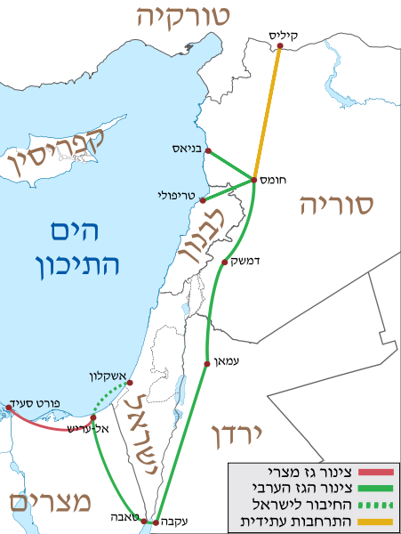
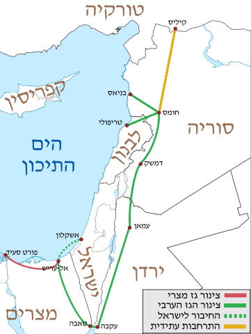
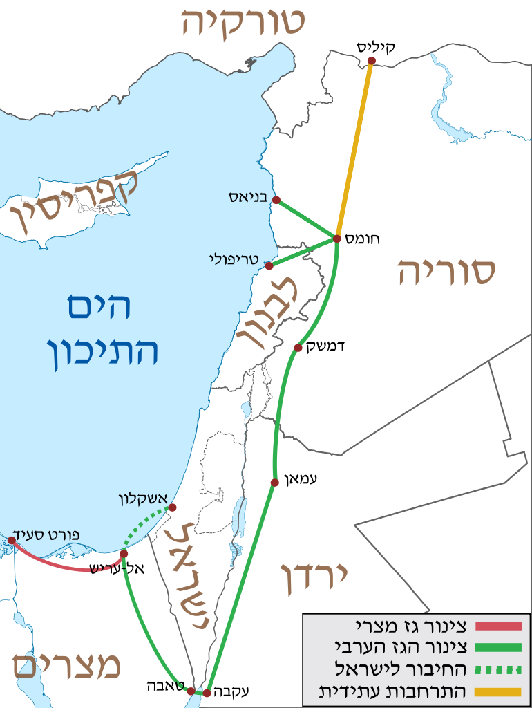
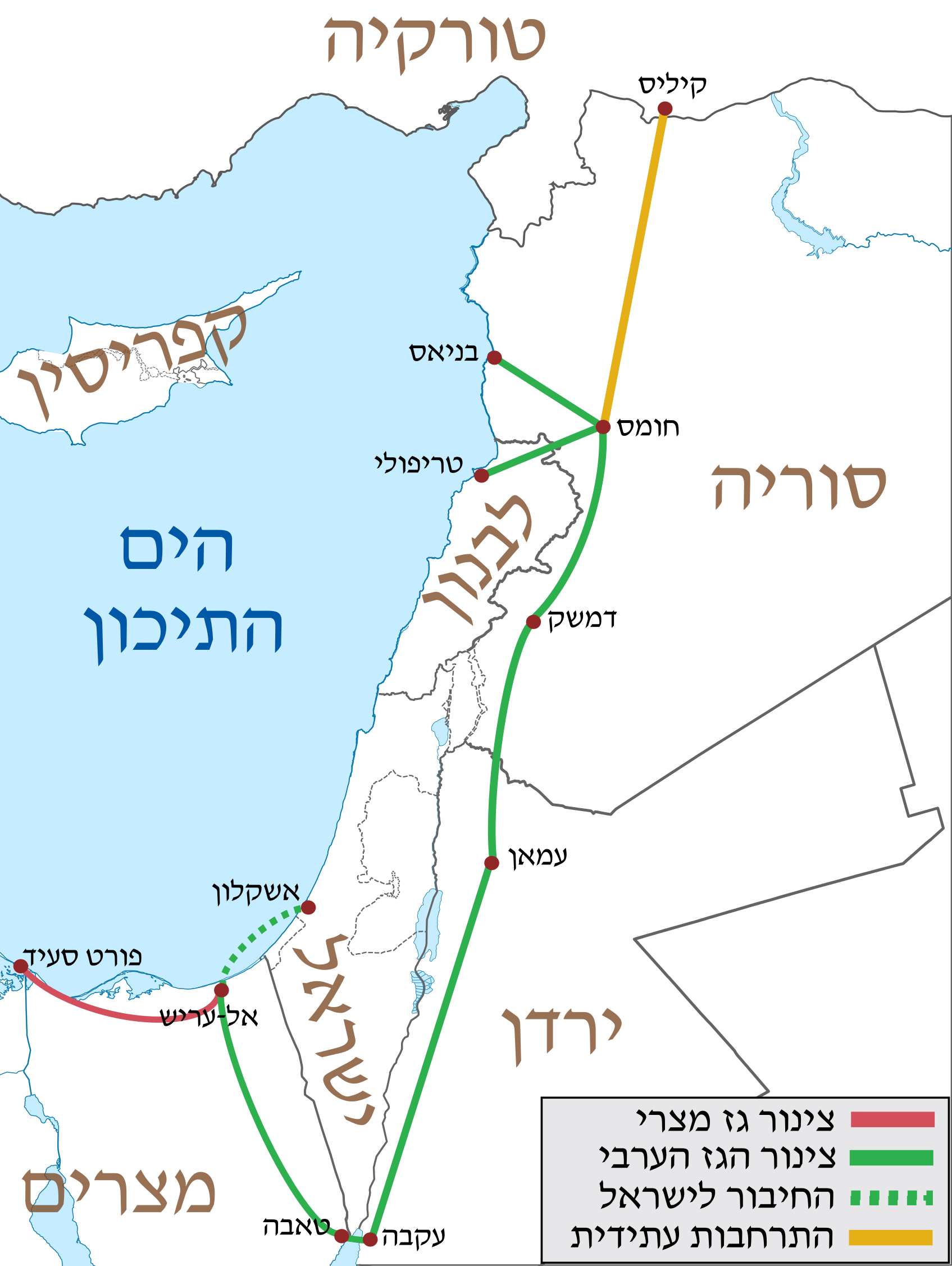
Deutsch: Positionskarte von Jordanien Quadratische Plattkarte, N-S-Streckung 115 %. Geographische Begrenzung der Karte: * N: 33.5° N * S: 29.1° N * W: 34.8° O * O: 39.4° O English: Location map of Jordan Equirectangular projection, N/S stretching 115 %. Geographic limits of the map: * N: 33.5° N * S: 29.1° N * W: 34.8° E * E: 39.4° E |
| Date | (UTC) |
| Source | |
| Author |
|
| This is a retouched picture, which means that it has been digitally altered from its original version. Modifications: hebrew. The original can be viewed here: Arab Gas Pipeline.svg:
|
Licensing
edit
I, the copyright holder of this work, hereby publish it under the following license:
This file is licensed under the Creative Commons Attribution-Share Alike 3.0 Germany license.
- You are free:
- to share – to copy, distribute and transmit the work
- to remix – to adapt the work
- Under the following conditions:
- attribution – You must give appropriate credit, provide a link to the license, and indicate if changes were made. You may do so in any reasonable manner, but not in any way that suggests the licensor endorses you or your use.
- share alike – If you remix, transform, or build upon the material, you must distribute your contributions under the same or compatible license as the original.

Original upload log
edit
This image is a derivative work of the following images:
- File:Arab_Gas_Pipeline.svg licensed with Cc-by-sa-3.0-de
- 2011-10-18T13:11:36Z Amirki 1816x2254 (617474 Bytes) /
- 2011-10-18T13:07:43Z Amirki 1816x2254 (617472 Bytes) == {{int:filedesc}} == {{Information |Description={{de|Positionskarte von [[:de:Jordanien|Jordanien]]}} Quadratische Plattkarte, N-S-Streckung 115 %. Geographische Begrenzung der Karte: * N: 33.5° N * S: 29.1° N * W: 34.8°
Uploaded with derivativeFX
File history
Click on a date/time to view the file as it appeared at that time.
| Date/Time | Thumbnail | Dimensions | User | Comment | |
|---|---|---|---|---|---|
| current | 18:49, 18 October 2011 | | 1,695 × 2,254 (693 KB) | Amirki (talk | contribs) | תיקון |
| 13:21, 18 October 2011 |  | 1,718 × 2,254 (687 KB) | Amirki (talk | contribs) | == {{int:filedesc}} == {{Information |Description={{de|Positionskarte von Jordanien}} Quadratische Plattkarte, N-S-Streckung 115 %. Geographische Begrenzung der Karte: * N: 33.5° N * S: 29.1° N * W: 34.8° O * O: 39.4° O {{en|Location |
You cannot overwrite this file.
File usage on Commons
There are no pages that use this file.
File usage on other wikis
The following other wikis use this file:
- Usage on he.wikipedia.org