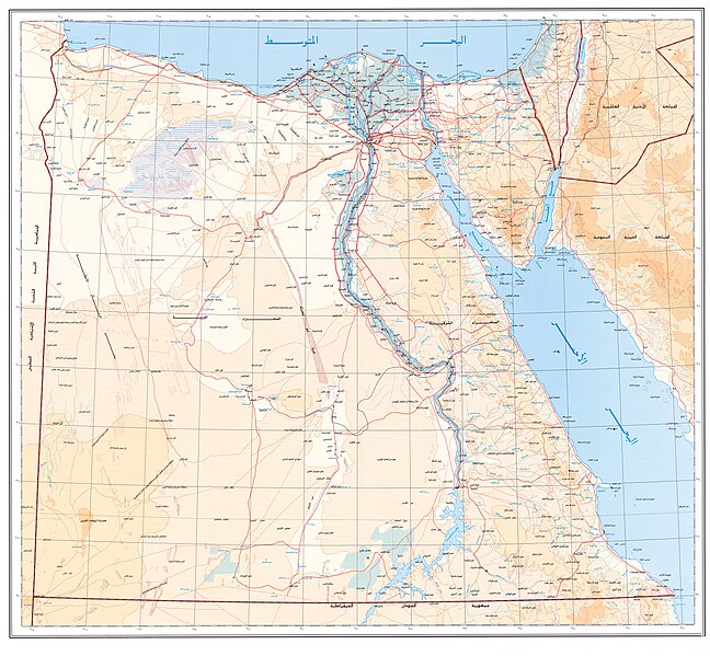
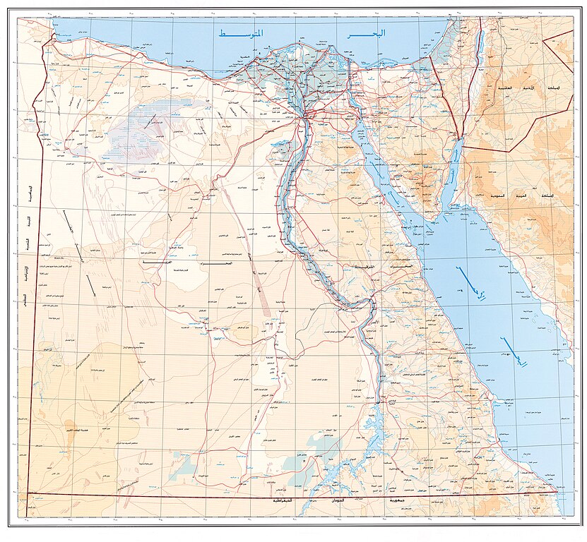
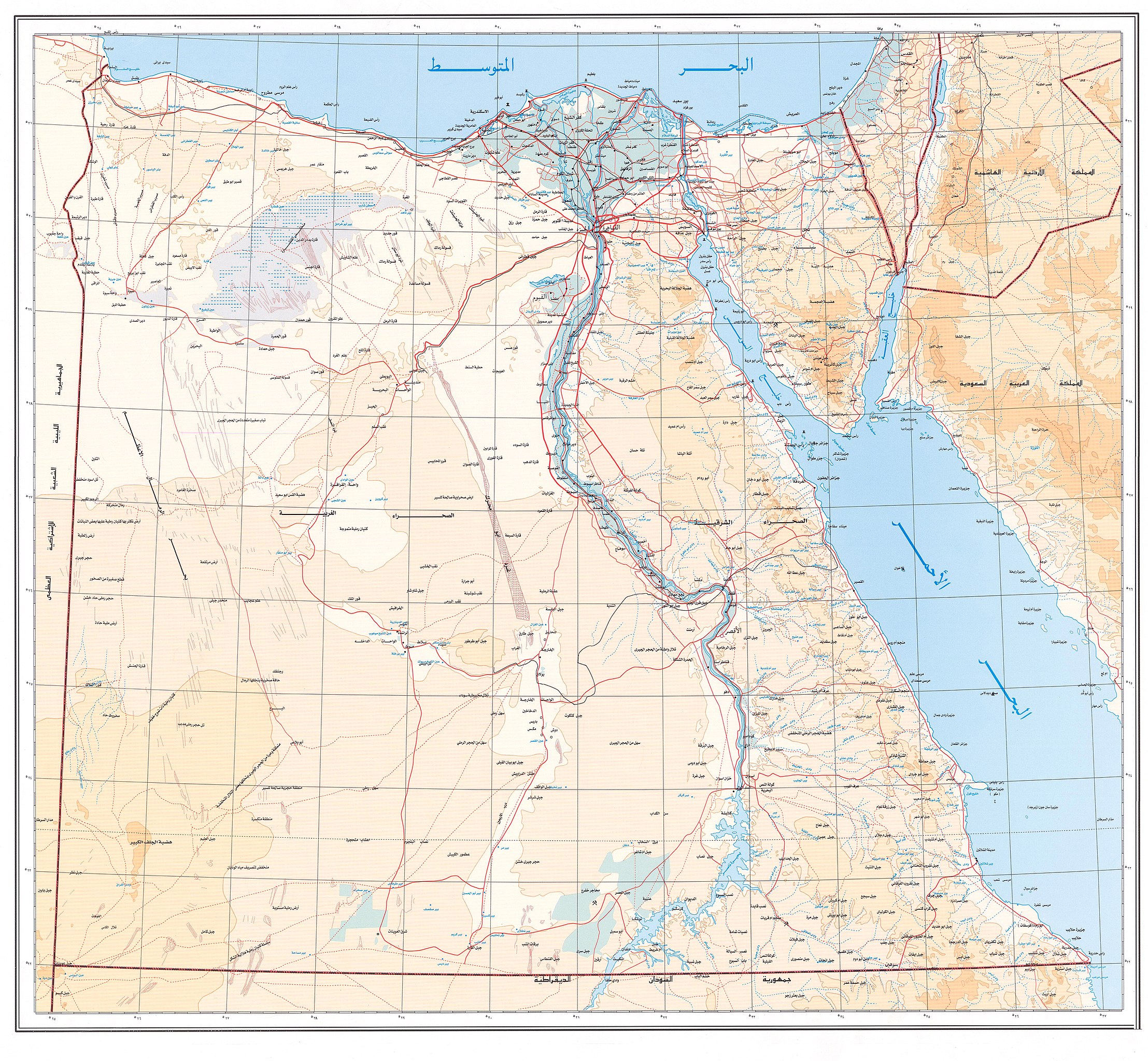
File:خريطة جمهورية مصر العربية.jpg

Size of this preview: 648 × 599 pixels. Other resolutions: 260 × 240 pixels | 519 × 480 pixels | 831 × 768 pixels | 1,108 × 1,024 pixels | 2,215 × 2,048 pixels | 2,784 × 2,574 pixels.
Original file (2,784 × 2,574 pixels, file size: 6.78 MB, MIME type: image/jpeg)
Captions
Captions
Add a one-line explanation of what this file represents
Summary edit
| Description |
العربية: خريطة جمهورية مصر العربية |
| Date | |
| Source | http://www.sis.gov.eg |
| Author | الهيئة العامة للاستعلامات Egypt State Information Service (SIS) |
Licensing edit
| This work is not an object of copyright in Egypt because it is an official document. Regardless of their source or target language, all official documents are ineligible for protection in Egypt, including laws, regulations, resolutions and decisions, international conventions, court decisions, award of arbitrators and decisions of administrative committees having judicial competence. (Article 141 of Intellectual Property Law 82 of 2002) | 
|
File history
Click on a date/time to view the file as it appeared at that time.
| Date/Time | Thumbnail | Dimensions | User | Comment | |
|---|---|---|---|---|---|
| current | 11:47, 30 January 2015 | | 2,784 × 2,574 (6.78 MB) | د. فارس الجويلي (talk | contribs) | User created page with UploadWizard |
You cannot overwrite this file.
File usage on Commons
There are no pages that use this file.
File usage on other wikis
The following other wikis use this file:
- Usage on ar.wikipedia.org
- محافظة القاهرة
- محافظة دمياط
- محافظة الإسكندرية
- محافظة السويس
- مصلحة الحدود
- محافظة القنال
- جزيرة بني نصر (عمل)
- الشرقية (عمل)
- قالب:وحدات إدارية مصرية قديمة
- القليوبية (عمل)
- المرتاحية (عمل)
- جزيرة قوسينا (عمل)
- السمنودية (عمل)
- المنوفية (عمل)
- الدقهلية (عمل)
- الدقهلية والمرتاحية (عمل)
- الدنجاوية (عمل)
- فوه والمزاحمتين (عمل)
- الكفور الشاسعة (عمل)
- حوف رمسيس (عمل)
- الروك الصلاحي
- الروك الناصري
- الأبوانية (عمل)
- البحيرة (عمل)
- الغربية (عمل)
- النستراوية (عمل)
- ضواحي الإسكندرية (عمل)
- ضواحي دمياط (عمل)
- ضواحي القاهرة (عمل)
- البوصيرية (عمل)
- الفيومية (عمل)
- الأطفيحية (عمل)
- البهنساوية (عمل)
- الأشمونين (عمل)
- المنفلوطية (عمل)
- الأسيوطية (عمل)
- الأخميمية (عمل)
- القوصية (عمل)
- الأهرامات المصرية الإقليمية