File:兰州到临洮高速-3 - panoramio.jpg
![File:兰州到临洮高速-3 - panoramio.jpg](https://upload.wikimedia.org/wikipedia/commons/thumb/2/24/%E5%85%B0%E5%B7%9E%E5%88%B0%E4%B8%B4%E6%B4%AE%E9%AB%98%E9%80%9F-3_-_panoramio.jpg/800px-%E5%85%B0%E5%B7%9E%E5%88%B0%E4%B8%B4%E6%B4%AE%E9%AB%98%E9%80%9F-3_-_panoramio.jpg?20161216103606)
Size of this preview: 800 × 600 pixels. Other resolutions: 320 × 240 pixels | 640 × 480 pixels | 1,024 × 768 pixels | 1,280 × 960 pixels | 2,592 × 1,944 pixels.
Original file (2,592 × 1,944 pixels, file size: 942 KB, MIME type: image/jpeg)
File information
Structured data
Captions
Captions
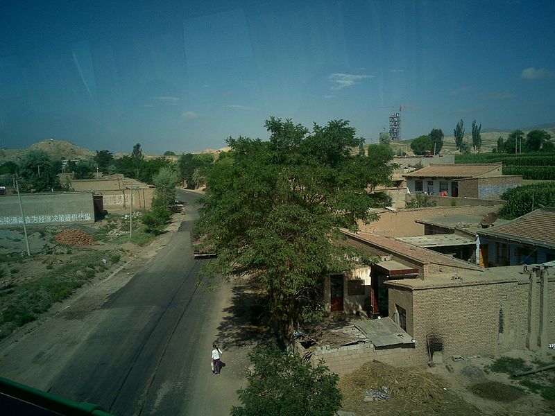
G75 passing over G212 in Zhongpu Town, Lintao County, Dingxi City, Gansu
Summary
editDescription兰州到临洮高速-3 - panoramio.jpg | 兰州到临洮高速-3 | ||
Date | Taken on 27 July 2010 | ||
Source | https://web.archive.org/web/20161014155408/http://www.panoramio.com/photo/38764835 | ||
Author | dayu490301 | ||
Permission (Reusing this file) |
![]() ![]() This file is licensed under the Creative Commons Attribution 3.0 Unported license. Attribution: dayu490301
|
||
Tags (from Panoramio photo page) InfoField | Dingxi , 临洮 |
Camera location | 35° 47′ 14.64″ N, 103° 44′ 09.16″ E ![]() | View this and other nearby images on: OpenStreetMap | ![]() |
---|
File history
Click on a date/time to view the file as it appeared at that time.
Date/Time | Thumbnail | Dimensions | User | Comment | |
---|---|---|---|---|---|
current | 10:36, 16 December 2016 | ![]() | 2,592 × 1,944 (942 KB) | Panoramio upload bot (talk | contribs) | == {{int:filedesc}} == {{Information |description=兰州到临洮高速-3 |date={{Taken on|2010-07-27}} |source=http://www.panoramio.com/photo/38764835 |author=[http://www.panoramio.com/user/3386612?with_photo_id=38764835 dayu490301] |permission={{cc-b... |
You cannot overwrite this file.
File usage on Commons
There are no pages that use this file.
File usage on other wikis
The following other wikis use this file:
- Usage on en.wikipedia.org
- Usage on ko.wikipedia.org
Metadata
This file contains additional information such as Exif metadata which may have been added by the digital camera, scanner, or software program used to create or digitize it. If the file has been modified from its original state, some details such as the timestamp may not fully reflect those of the original file. The timestamp is only as accurate as the clock in the camera, and it may be completely wrong.
Camera manufacturer | Nokia |
---|---|
Camera model | N96 |
Exposure time | 921/1,000,000 sec (0.000921) |
F-number | f/2.80078125 |
ISO speed rating | 40 |
Date and time of data generation | 09:52, 27 July 2010 |
Lens focal length | 5.2 mm |
Latitude | 35° 47′ 14.63″ N |
Longitude | 103° 44′ 9.17″ E |
Altitude | 1,973 meters above sea level |
Orientation | Normal |
Horizontal resolution | 300 dpi |
Vertical resolution | 300 dpi |
Software used | 30.033\n18-06-09\nRM-247\n(C) Nokia N96 |
File change date and time | 09:52, 27 July 2010 |
Y and C positioning | Centered |
Exif version | 2.2 |
Date and time of digitizing | 09:52, 27 July 2010 |
Meaning of each component |
|
APEX shutter speed | 10.0845 |
APEX aperture | 2.9716 |
Subject distance | 262.296 meters |
Metering mode | Spot |
Light source | Unknown |
Flash | Flash did not fire, auto mode |
Supported Flashpix version | 1 |
Color space | sRGB |
Exposure index | 12 |
Custom image processing | Custom process |
Exposure mode | Auto exposure |
White balance | Auto white balance |
Digital zoom ratio | 1 |
Scene capture type | Standard |
Scene control | None |
Contrast | Soft |
GPS tag version | 0.0.2.2 |