File:安坑輕軌安心橋空拍照.jpg

Size of this preview: 800 × 450 pixels. Other resolutions: 320 × 180 pixels | 640 × 360 pixels | 1,024 × 576 pixels | 1,280 × 720 pixels | 2,560 × 1,440 pixels | 4,000 × 2,250 pixels.
Original file (4,000 × 2,250 pixels, file size: 4.82 MB, MIME type: image/jpeg)
Captions
Captions
Add a one-line explanation of what this file represents
Summary
edit
| Description |
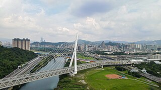
中文(臺灣):安坑輕軌安心橋空拍照 |
| Date | |
| Source | https://www.ntpc.gov.tw/uploaddowndoc?file=news/202302021713452.jpg&filedisplay=%E5%AE%89%E5%9D%91%E8%BC%95%E8%BB%8C%E5%AE%89%E5%BF%83%E6%A9%8B%E7%A9%BA%E6%8B%8D%E7%85%A7.jpg&flag=pic |
| Author | 新北市政府 |
| Camera location | | View this and other nearby images on: OpenStreetMap |
|---|
Licensing
edit

|
The copyright holder of this file, New Taipei City Government, allows anyone to use it for any purpose, provided that the copyright holder is properly attributed. Redistribution, derivative work, commercial use, and all other use is permitted. |
Attribution:
|
|
|
This file is licensed under the Government Website Open Information Announcement.
Information on Related Items:
|
 |
|
|
File history
Click on a date/time to view the file as it appeared at that time.
| Date/Time | Thumbnail | Dimensions | User | Comment | |
|---|---|---|---|---|---|
| current | 14:37, 1 June 2023 | | 4,000 × 2,250 (4.82 MB) | 鐵路1 (talk | contribs) | Uploaded a work by 新北市政府 from https://www.ntpc.gov.tw/uploaddowndoc?file=news/202302021713452.jpg&filedisplay=%E5%AE%89%E5%9D%91%E8%BC%95%E8%BB%8C%E5%AE%89%E5%BF%83%E6%A9%8B%E7%A9%BA%E6%8B%8D%E7%85%A7.jpg&flag=pic with UploadWizard |
You cannot overwrite this file.
File usage on Commons
The following page uses this file:
File usage on other wikis
The following other wikis use this file:
- Usage on www.wikidata.org