File:最近踏査新領樺太明細全図.jpg

Size of this preview: 415 × 599 pixels. Other resolutions: 166 × 240 pixels | 332 × 480 pixels | 532 × 768 pixels | 709 × 1,024 pixels | 1,419 × 2,048 pixels | 5,476 × 7,905 pixels.
Original file (5,476 × 7,905 pixels, file size: 38.61 MB, MIME type: image/jpeg)
Captions
Captions
Add a one-line explanation of what this file represents
Summary
edit
| Description |
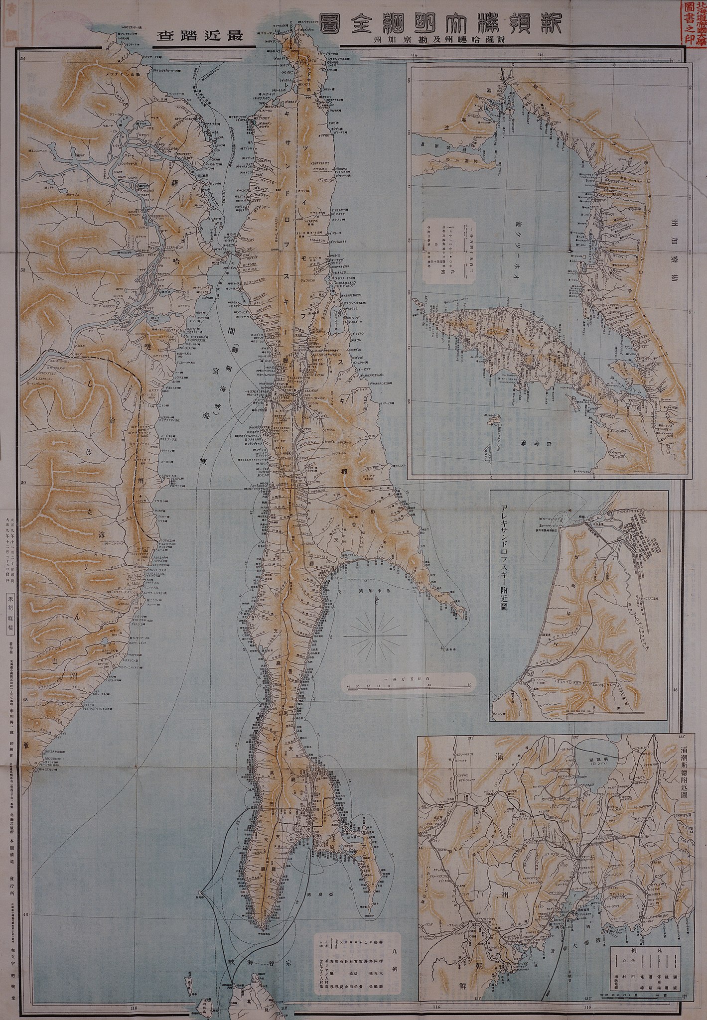
日本語: 大正時代の樺太全島および沿海州の地図。北海道大学附属図書館所蔵。 |
| Date | |
| Source | 北海道大学北方資料データベース https://www2.lib.hokudai.ac.jp/hoppodb/ |
| Author | 市川天涯 |
Licensing
edit
This work is in the public domain in the United States because it was published (or registered with the U.S. Copyright Office) before January 1, 1929.
Public domain works must be out of copyright in both the United States and in the source country of the work in order to be hosted on the Commons. If the work is not a U.S. work, the file must have an additional copyright tag indicating the copyright status in the source country.
Note: This tag should not be used for sound recordings. |
File history
Click on a date/time to view the file as it appeared at that time.
| Date/Time | Thumbnail | Dimensions | User | Comment | |
|---|---|---|---|---|---|
| current | 14:51, 19 January 2023 | | 5,476 × 7,905 (38.61 MB) | あずきごはん (talk | contribs) | Uploaded a work by 市川天涯 from 北海道大学北方資料データベース https://www2.lib.hokudai.ac.jp/hoppodb/ with UploadWizard |
You cannot overwrite this file.
File usage on Commons
There are no pages that use this file.
File usage on other wikis
The following other wikis use this file:
- Usage on ja.wikipedia.org