File:石頭營聖蹟亭<2>.jpg
![File:石頭營聖蹟亭<2>.jpg](https://upload.wikimedia.org/wikipedia/commons/thumb/4/4c/%E7%9F%B3%E9%A0%AD%E7%87%9F%E8%81%96%E8%B9%9F%E4%BA%AD%EF%BC%9C2%EF%BC%9E.jpg/800px-%E7%9F%B3%E9%A0%AD%E7%87%9F%E8%81%96%E8%B9%9F%E4%BA%AD%EF%BC%9C2%EF%BC%9E.jpg?20210927080535)
Original file (5,664 × 4,248 pixels, file size: 8.25 MB, MIME type: image/jpeg)
Captions
Captions
Summary
editDescription石頭營聖蹟亭<2>.jpg |
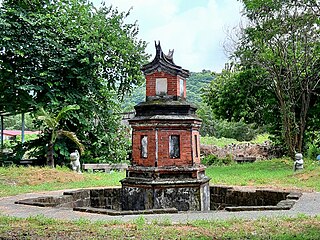
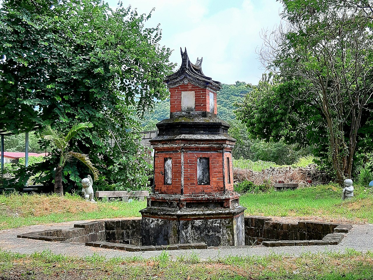
中文(繁體):「石頭營聖蹟亭」名稱應源自於石頭營駐紮之意,但以史蹟考證而言,實應正名為「大餉營聖蹟亭」。
在歷史上,台灣之惜字亭多出於書院寺廟、聚落附近,鮮有設於營區者,石頭營聖蹟亭為全台僅有。 沈葆禎、丁日昌前後二任之開山撫番事蹟多為古道、碑碣,石頭營聖蹟亭位於通往後山地區之古道起點,十分特別,同時其為番社學產物,為當年企圖使原住民漢化的明證,深具歷史意義。 石頭營聖蹟亭的確切建成年代不可考,但最遲應在光緒二年(1876)即已建成。 |
Date | |
Source | Own work |
Author | WEI, WAN-CHEN(魏琬臻) |
Camera location | 22° 25′ 30″ N, 120° 37′ 06″ E ![]() | View this and other nearby images on: OpenStreetMap | ![]() |
---|
Licensing
edit![w:en:Creative Commons](https://upload.wikimedia.org/wikipedia/commons/thumb/7/79/CC_some_rights_reserved.svg/90px-CC_some_rights_reserved.svg.png)
![attribution](https://upload.wikimedia.org/wikipedia/commons/thumb/1/11/Cc-by_new_white.svg/24px-Cc-by_new_white.svg.png)
![share alike](https://upload.wikimedia.org/wikipedia/commons/thumb/d/df/Cc-sa_white.svg/24px-Cc-sa_white.svg.png)
- You are free:
- to share – to copy, distribute and transmit the work
- to remix – to adapt the work
- Under the following conditions:
- attribution – You must give appropriate credit, provide a link to the license, and indicate if changes were made. You may do so in any reasonable manner, but not in any way that suggests the licensor endorses you or your use.
- share alike – If you remix, transform, or build upon the material, you must distribute your contributions under the same or compatible license as the original.
![]() |
This image was uploaded as part of Wiki Loves Monuments 2021.
Afrikaans ∙ Alemannisch ∙ azərbaycanca ∙ Bahasa Indonesia ∙ Bahasa Melayu ∙ Bikol Central ∙ bosanski ∙ brezhoneg ∙ català ∙ čeština ∙ Cymraeg ∙ dansk ∙ davvisámegiella ∙ Deutsch ∙ eesti ∙ English ∙ español ∙ Esperanto ∙ euskara ∙ français ∙ Frysk ∙ Gaeilge ∙ galego ∙ hrvatski ∙ Ido ∙ italiano ∙ latviešu ∙ Lëtzebuergesch ∙ Malagasy ∙ magyar ∙ Malti ∙ Nederlands ∙ norsk ∙ norsk nynorsk ∙ norsk bokmål ∙ polski ∙ português ∙ português do Brasil ∙ română ∙ shqip ∙ sicilianu ∙ slovenčina ∙ slovenščina ∙ suomi ∙ svenska ∙ Tagalog ∙ Türkçe ∙ Yorùbá ∙ Zazaki ∙ Ελληνικά ∙ беларуская ∙ беларуская (тарашкевіца) ∙ български ∙ кыргызча ∙ македонски ∙ русский ∙ српски / srpski ∙ українська ∙ ქართული ∙ հայերեն ∙ नेपाली ∙ हिन्दी ∙ বাংলা ∙ മലയാളം ∙ ไทย ∙ 한국어 ∙ +/− |
![]() |
File history
Click on a date/time to view the file as it appeared at that time.
Date/Time | Thumbnail | Dimensions | User | Comment | |
---|---|---|---|---|---|
current | 08:05, 27 September 2021 | ![]() | 5,664 × 4,248 (8.25 MB) | WEI, WAN-CHEN (talk | contribs) | Uploaded own work with UploadWizard |
You cannot overwrite this file.
File usage on Commons
The following page uses this file:
Metadata
This file contains additional information such as Exif metadata which may have been added by the digital camera, scanner, or software program used to create or digitize it. If the file has been modified from its original state, some details such as the timestamp may not fully reflect those of the original file. The timestamp is only as accurate as the clock in the camera, and it may be completely wrong.
Camera manufacturer | samsung |
---|---|
Camera model | SM-A750GN |
Date and time of data generation | 12:34, 26 September 2021 |
Exposure time | 1/694 sec (0.0014409221902017) |
F-number | f/1.7 |
ISO speed rating | 40 |
Lens focal length | 3.93 mm |
Latitude | 22° 25′ 30″ N |
Altitude | 87 meters above sea level |
Longitude | 120° 37′ 6″ E |
Height | 4,248 px |
Orientation | 0 |
File change date and time | 15:58, 27 September 2021 |
Vertical resolution | 72 dpi |
Horizontal resolution | 72 dpi |
Width | 5,664 px |
Software used | A750GNDXU5CTC5 |
Y and C positioning | Centered |
APEX aperture | 1.53 |
Scene type | A directly photographed image |
Exif version | 2.2 |
APEX exposure bias | 0 |
Exposure Program | Normal program |
Unique image ID | B24LSLF01AM B24LSNC04AA |
Color space | sRGB |
Maximum land aperture | 1.53 APEX (f/1.7) |
APEX brightness | 7.64 |
Supported Flashpix version | 1 |
DateTimeOriginal subseconds | 0247 |
White balance | Auto white balance |
Custom image processing | Normal process |
Exposure mode | Auto exposure |
Flash | Flash did not fire |
DateTime subseconds | 0247 |
Saturation | Normal |
Meaning of each component |
|
Focal length in 35 mm film | 27 mm |
DateTimeDigitized subseconds | 0247 |
Sharpness | Normal |
Contrast | Normal |
Date and time of digitizing | 12:34, 26 September 2021 |
APEX shutter speed | 10.45 |
Metering mode | Center weighted average |
Scene capture type | Standard |
Light source | Unknown |
GPS time (atomic clock) | 04:34 |
GPS date | 26 September 2021 |
GPS tag version | 2.2.0.0 |