File:福州市城市轨道交通线网调整方案示意图(远景).jpg
Size of this preview: 800 × 574 pixels. Other resolutions: 320 × 230 pixels | 640 × 459 pixels | 1,024 × 735 pixels | 1,280 × 918 pixels | 2,409 × 1,728 pixels.
Original file (2,409 × 1,728 pixels, file size: 1.27 MB, MIME type: image/jpeg)
Captions
Captions
Add a one-line explanation of what this file represents
Summary edit
| Description |
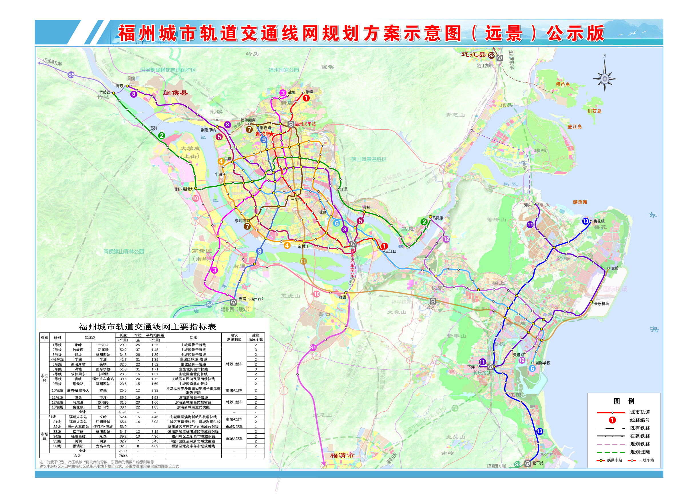
中文(中国大陆):福州市城市轨道交通线网调整方案示意图(远景) |
| Date | |
| Source | 福州城市轨道交通线网规划(2021年修编)公示. |
| Author | 福州地铁集团 |
Licensing edit
Copyright Law of the People's Republic of China: Article 5 This law shall not apply to:
|
 | |
|
This work is from any of the items above and is in the public domain in Mainland China and possibly other jurisdictions. For works whose copyright has expired, see also {{PD-China}} and {{PD-PRC}}. | ||
File history
Click on a date/time to view the file as it appeared at that time.
| Date/Time | Thumbnail | Dimensions | User | Comment | |
|---|---|---|---|---|---|
| current | 10:05, 8 December 2022 | | 2,409 × 1,728 (1.27 MB) | Transparence1 (talk | contribs) | 福州市城市轨道交通线网调整方案示意图(远景).jpg |
| 08:56, 6 September 2018 |  | 4,961 × 3,508 (9.54 MB) | SCJiang (talk | contribs) | Version Sept.4th | |
| 03:37, 26 August 2018 |  | 4,961 × 3,508 (9.85 MB) | 董辰兴 (talk | contribs) | User created page with UploadWizard |
You cannot overwrite this file.
File usage on Commons
The following 10 pages use this file:
- User:Chumwa/OgreBot/Potential transport maps/2018 August 21-31
- User:Chumwa/OgreBot/Potential transport maps/2018 September 1-10
- User:Chumwa/OgreBot/Public transport information/2018 August 21-31
- User:Chumwa/OgreBot/Public transport information/2018 September 1-10
- User:Chumwa/OgreBot/Public transport information/2022 December 1-10
- User:Chumwa/OgreBot/Transport Maps/2018 August 21-31
- User:Chumwa/OgreBot/Transport Maps/2018 September 1-10
- User:Chumwa/OgreBot/Transport Maps/2022 December 1-10
- User:Chumwa/OgreBot/Travel and communication maps/2018 August 21-31
- User:Chumwa/OgreBot/Travel and communication maps/2018 September 1-10
File usage on other wikis
The following other wikis use this file:
- Usage on zh.wikisource.org
.jpg&oldid=721349594)