File:西勢大溪反水路.jpg

Size of this preview: 800 × 569 pixels. Other resolutions: 320 × 228 pixels | 640 × 455 pixels | 1,024 × 729 pixels | 1,280 × 911 pixels | 2,560 × 1,821 pixels | 3,508 × 2,496 pixels.
Original file (3,508 × 2,496 pixels, file size: 5.66 MB, MIME type: image/jpeg)
Captions
Captions
Add a one-line explanation of what this file represents
Summary
edit
| Description |
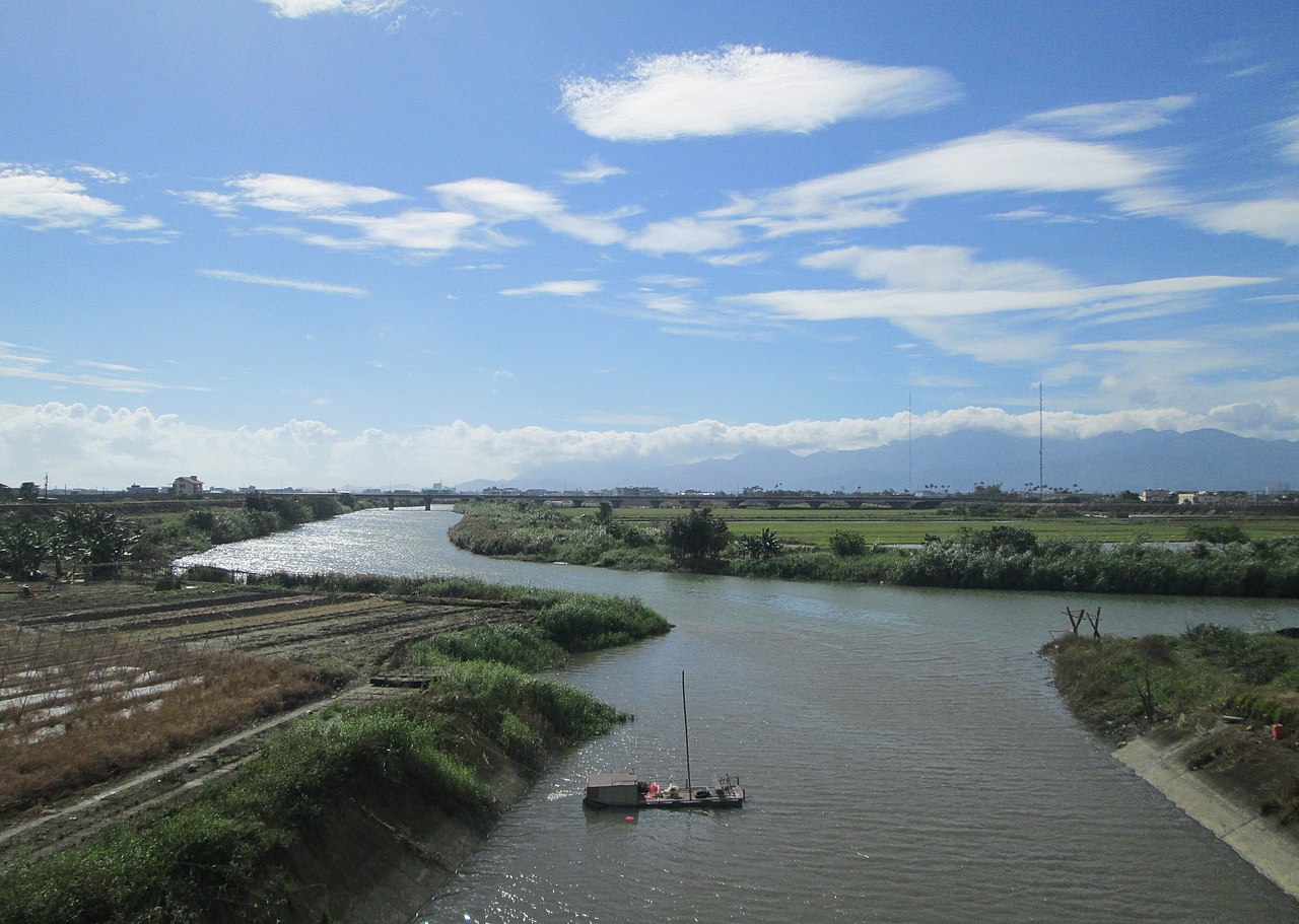
中文(臺灣): 宜蘭平原因地理位置及地形因素,河水只能彎彎曲曲尋求出路,特別是下游河口地區,常堆沙成汕,當洪汛來臨,大水沖開淤塞,則河川復通,否則就決堤改道。昔日蘭陽溪出平陽後,於內城岔分為二,其一續向東北流至烏石港出海者,為西勢大溪 (昔稱清水溪,今宜蘭河),另一轉向東流至加禮宛出海者,為東勢大溪 (俗稱濁水溪,今蘭陽溪),二溪常互相襲奪而釀災。
西勢大溪據文獻記載,從濁水溪同源於南湖大山,在內城分流,匯總溪北諸水,再從烏石港出海,流長80多公里,1878年西勢大溪尾段之頭圍河氾濫,河川改道從打馬烟出海,1892年又從七張改道流至廍後出海; 1936年濁水溪治水工程完成之後,「再連堤防」將清水溪、濁水溪分隔,流長剩25公里,西勢大溪反水路印證宜蘭河川水文特性。(備註:反水路為河道改變之意) |
| Source | https://memory.culture.tw/Home/Detail?Id=602990&IndexCode=Culture_Place |
| Author | 創作者:莊文生;鐘碧娟;謝淑娟。貢獻者:宜蘭縣政府文化局 |
| Camera location | | View this and other nearby images on: OpenStreetMap |
|---|
Licensing
edit
This file is licensed under the Creative Commons Attribution 3.0 Taiwan license.
- You are free:
- to share – to copy, distribute and transmit the work
- to remix – to adapt the work
- Under the following conditions:
- attribution – You must give appropriate credit, provide a link to the license, and indicate if changes were made. You may do so in any reasonable manner, but not in any way that suggests the licensor endorses you or your use.

File history
Click on a date/time to view the file as it appeared at that time.
| Date/Time | Thumbnail | Dimensions | User | Comment | |
|---|---|---|---|---|---|
| current | 04:51, 14 April 2022 | | 3,508 × 2,496 (5.66 MB) | Muyueh Bot (talk | contribs) |
You cannot overwrite this file.
File usage on Commons
There are no pages that use this file.