File:赵州位置图1820.svg

Size of this PNG preview of this SVG file: 479 × 599 pixels. Other resolutions: 192 × 240 pixels | 384 × 480 pixels | 614 × 768 pixels | 819 × 1,024 pixels | 1,638 × 2,048 pixels | 595 × 744 pixels.
Original file (SVG file, nominally 595 × 744 pixels, file size: 1.68 MB)
Captions
Captions
Add a one-line explanation of what this file represents
Summary
edit
| Description |
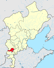
中文(简体):1820年直隶省所辖各府/直隶州/直隶厅位置图。
原始数据来自中国历史地理信息系统(CHGIS)V6 1820图层:https://dataverse.harvard.edu/dataset.xhtml?persistentId=doi:10.7910/DVN/ST5KKM,原数据以CC0 1.0协议发布。 原数据有误:省界图层山东在直隶清河县以西有一块飞地,府界图层该飞地无数据,经查《中国历史地图集》,画入直隶冀州。 |
| Date | |
| Source | Own work |
| Author | 瑞丽江的河水 |
Licensing
edit
I, the copyright holder of this work, hereby publish it under the following license:
This file is licensed under the Creative Commons Attribution-Share Alike 4.0 International license.
- You are free:
- to share – to copy, distribute and transmit the work
- to remix – to adapt the work
- Under the following conditions:
- attribution – You must give appropriate credit, provide a link to the license, and indicate if changes were made. You may do so in any reasonable manner, but not in any way that suggests the licensor endorses you or your use.
- share alike – If you remix, transform, or build upon the material, you must distribute your contributions under the same or compatible license as the original.
File history
Click on a date/time to view the file as it appeared at that time.
| Date/Time | Thumbnail | Dimensions | User | Comment | |
|---|---|---|---|---|---|
| current | 04:18, 23 December 2023 | | 595 × 744 (1.68 MB) | 瑞丽江的河水 (talk | contribs) | Uploaded own work with UploadWizard |
You cannot overwrite this file.
File usage on Commons
There are no pages that use this file.
File usage on other wikis
The following other wikis use this file:
- Usage on zh.wikipedia.org