File:远望狮屿 - Lion Islet - 2014.09 - panoramio.jpg
Size of this preview: 799 × 599 pixels. Other resolutions: 320 × 240 pixels | 640 × 480 pixels | 1,024 × 768 pixels | 1,280 × 960 pixels | 2,560 × 1,920 pixels | 4,249 × 3,187 pixels.
Original file (4,249 × 3,187 pixels, file size: 3.67 MB, MIME type: image/jpeg)
Captions
Captions
Lion Islet
Summary edit
| Description |
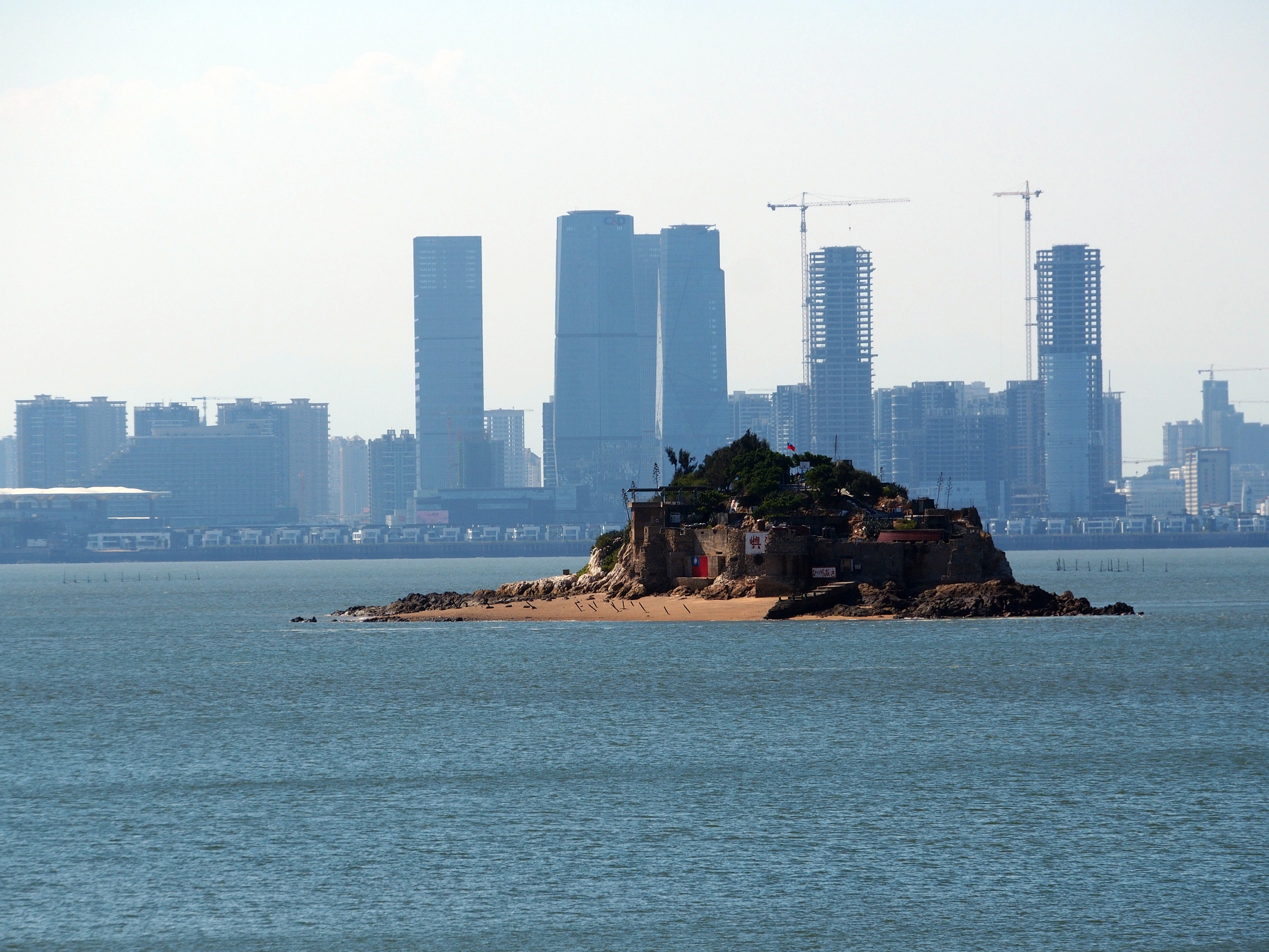
中文(臺灣):遠望獅嶼 - 民國103年9月 中文(简体):远望狮屿 - 2014.09 English: Shi Islet (Lion Islet) (ROC-Taiwan) as seen from Lesser Kinmen (Lieyu), Lieyu Township, Kinmen County, (Fukien Province), ROC (Taiwan) with Siming District, Amoy Island, Xiamen, Fujian Province, PRC (China) in the background, and the beach west of the harbor front hiding the slaughtered fishermen corpses in 1985 - 2014.09 |
||
| Date | Taken on 7 September 2014 | ||
| Source | https://web.archive.org/web/20161101190117/http://www.panoramio.com/photo/116339111 | ||
| Author | rheins | ||
| Permission (Reusing this file) |
This file is licensed under the Creative Commons Attribution 3.0 Unported license. Attribution: rheins
|
||
| Panoramio Tags | best, 金門 - Kinmen |
| Camera location | | View this and other nearby images on: OpenStreetMap |
|---|
File history
Click on a date/time to view the file as it appeared at that time.
| Date/Time | Thumbnail | Dimensions | User | Comment | |
|---|---|---|---|---|---|
| current | 01:25, 20 May 2017 | | 4,249 × 3,187 (3.67 MB) | Panoramio upload bot (talk | contribs) | == {{int:filedesc}} == {{Information |description=远望狮屿 - Lion Islet - 2014.09 |date={{Taken on|2014-09-07}} |source=http://www.panoramio.com/photo/116339111 |author=[http://www.panoramio.com/user/5226993?with_photo_id=116339111 rheins] |permiss... |
You cannot overwrite this file.
File usage on Commons
The following page uses this file:
File usage on other wikis
The following other wikis use this file:
- Usage on ceb.wikipedia.org
- Usage on en.wikipedia.org
- Usage on fr.wikipedia.org
- Usage on ja.wikipedia.org
- Usage on vi.wikipedia.org
- Usage on www.wikidata.org
- Usage on zh.wikipedia.org