File:00-363 Goodenough Island.png
Size of this preview: 589 × 600 pixels. Other resolutions: 236 × 240 pixels | 471 × 480 pixels | 810 × 825 pixels.
Original file (810 × 825 pixels, file size: 344 KB, MIME type: image/png)
Captions
Captions
Add a one-line explanation of what this file represents
Summary
edit
| Description |
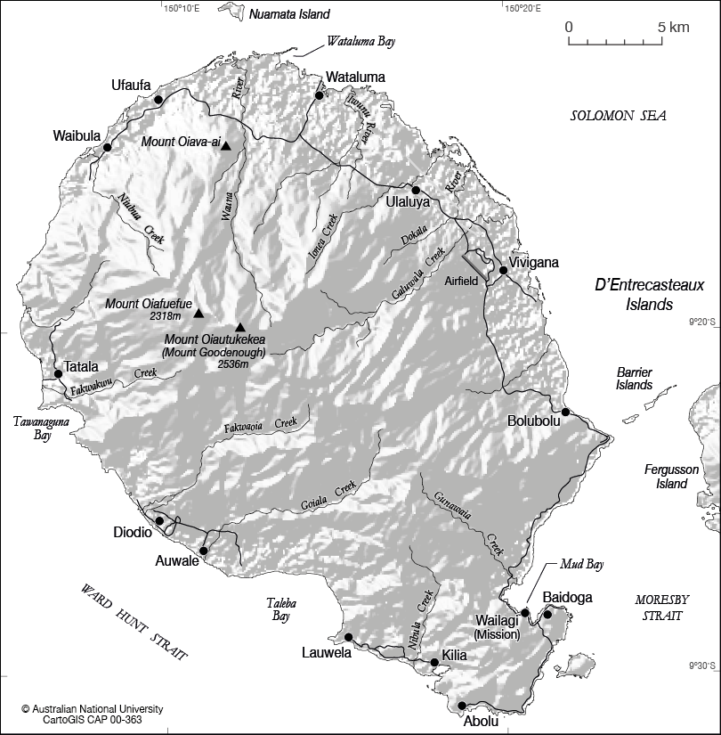
English: Black and white relief map of Goodenough Island (D'Entrecasteaux Islands, Milne Bay, Papua New Guinea), Solomon Sea, showing major settlements, rivers and mountains. |
| Date | not stated |
| Source | CartoGIS, College of Asia and the Pacific, The Australian National University, http://asiapacific.anu.edu.au/mapsonline/base-maps/goodenough-island |
| Author | CartoGIS, College of Asia and the Pacific, The Australian National University |
Licensing
edit
This file is licensed under the Creative Commons Attribution-Share Alike 4.0 International license.
- You are free:
- to share – to copy, distribute and transmit the work
- to remix – to adapt the work
- Under the following conditions:
- attribution – You must give appropriate credit, provide a link to the license, and indicate if changes were made. You may do so in any reasonable manner, but not in any way that suggests the licensor endorses you or your use.
- share alike – If you remix, transform, or build upon the material, you must distribute your contributions under the same or compatible license as the original.
File history
Click on a date/time to view the file as it appeared at that time.
| Date/Time | Thumbnail | Dimensions | User | Comment | |
|---|---|---|---|---|---|
| current | 06:29, 17 May 2019 | | 810 × 825 (344 KB) | Ratzer (talk | contribs) | User created page with UploadWizard |
You cannot overwrite this file.
File usage on Commons
There are no pages that use this file.
File usage on other wikis
The following other wikis use this file:
- Usage on de.wikipedia.org