File:00 0508 Blick von der Hängebrücke „Titlis Cliff Walk“ - Engelberg.jpg

Size of this preview: 800 × 533 pixels. Other resolutions: 320 × 213 pixels | 640 × 427 pixels | 1,024 × 683 pixels | 1,280 × 853 pixels | 2,560 × 1,707 pixels | 4,500 × 3,000 pixels.
Original file (4,500 × 3,000 pixels, file size: 10.45 MB, MIME type: image/jpeg)
Captions
Captions
Add a one-line explanation of what this file represents
Summary
edit| Description |
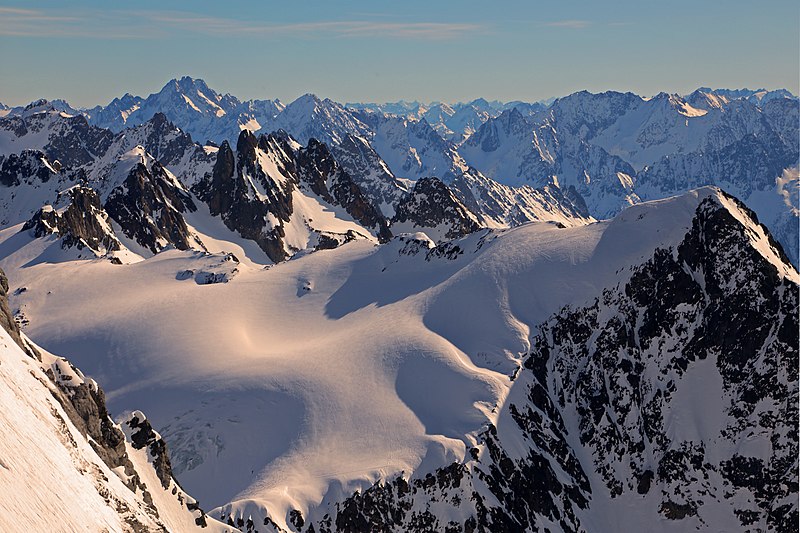
Deutsch: Panorama: Blick von der Hängebrücke „Titlis Cliff Walk“ in Richtung Südost auf die Berggruppe Wichelplanggstock – Grassen. Die Titlis (3.238 Meter NN) ist ein bekannter Ausflugsberg in der Gebirgsgruppe der Urner Alpen (bei Engelberg im Kanton Obwalden).
Simple English: View from the suspension bridge "Titlis Cliff Walk" in direction southeast on the mountain group Wichelplanggstock - Grassen. The Titlis (3,238 meters above sea level) is a well-known excursion mountain in the mountain range of the Uri Alps (near Engelberg in the canton of Obwalden). |
| Date | |
| Source | Own work |
| Author | W. Bulach |
| Other versions |

| Camera location | | View this and other nearby images on: OpenStreetMap |
|---|
Licensing
edit
I, the copyright holder of this work, hereby publish it under the following license:
This file is licensed under the Creative Commons Attribution-Share Alike 4.0 International license.
- You are free:
- to share – to copy, distribute and transmit the work
- to remix – to adapt the work
- Under the following conditions:
- attribution – You must give appropriate credit, provide a link to the license, and indicate if changes were made. You may do so in any reasonable manner, but not in any way that suggests the licensor endorses you or your use.
- share alike – If you remix, transform, or build upon the material, you must distribute your contributions under the same or compatible license as the original.
| Annotations | This image is annotated: View the annotations at Commons |
File history
Click on a date/time to view the file as it appeared at that time.
| Date/Time | Thumbnail | Dimensions | User | Comment | |
|---|---|---|---|---|---|
| current | 16:28, 8 April 2019 | | 4,500 × 3,000 (10.45 MB) | W. Bulach (talk | contribs) | User created page with UploadWizard |
You cannot overwrite this file.
File usage on Commons
The following 2 pages use this file:
File usage on other wikis
The following other wikis use this file:
- Usage on ceb.wikipedia.org
- Usage on www.wikidata.org