File:042 looking north from the loop.png

Size of this preview: 800 × 596 pixels. Other resolutions: 320 × 239 pixels | 640 × 477 pixels | 1,024 × 763 pixels | 1,280 × 954 pixels | 2,560 × 1,908 pixels.
Original file (2,560 × 1,908 pixels, file size: 8.38 MB, MIME type: image/png)
Captions
Captions
Add a one-line explanation of what this file represents
| Description |
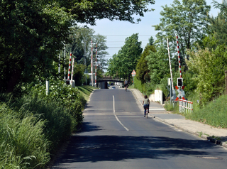
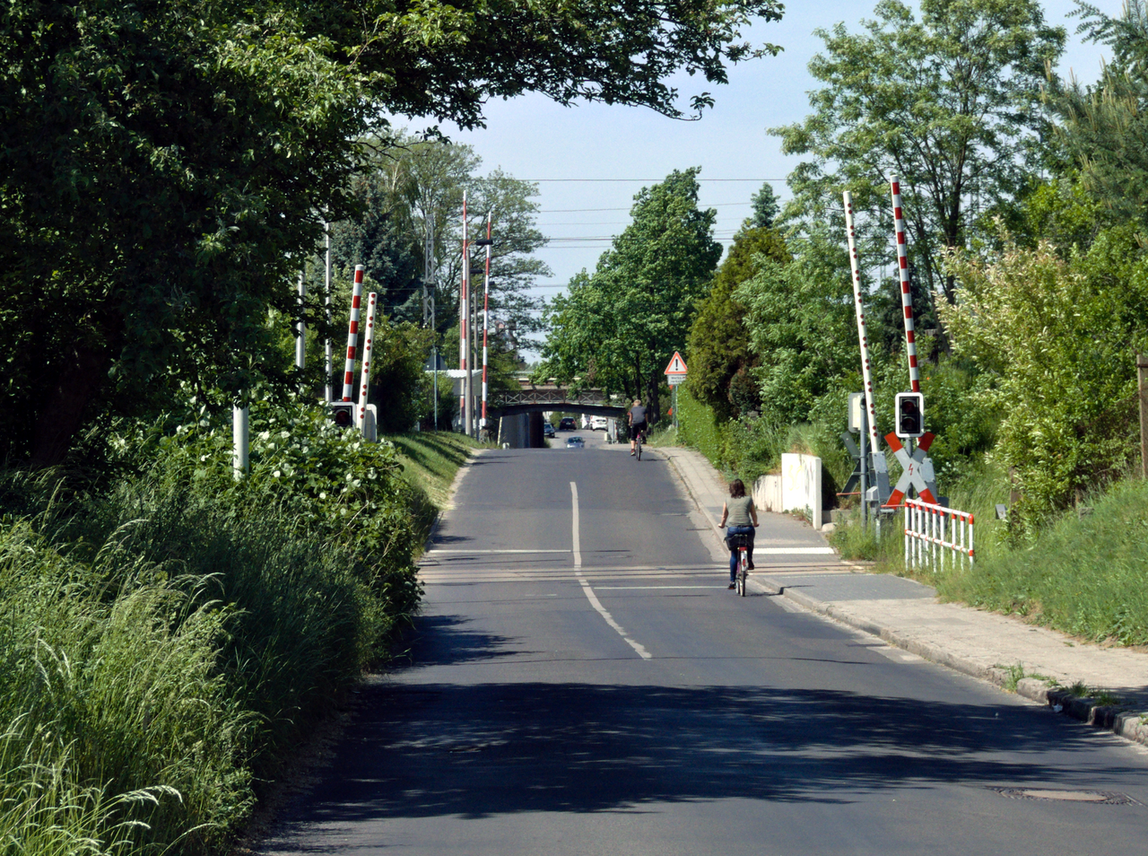
English: Looking down Sachsendorfer Straße, a narrow and bumpy road that crosses five tracks in total. Nevertheless, it is, in this area, the most direct connection between the districts Ströbitz (north) and Spremberger Vorstadt (south and where the terminal loop is located) and sees a considerable amount of traffic. |
| Date | |
| Source | Own work |
| Author | Trio3D |
| Camera location | | View this and other nearby images on: OpenStreetMap |
|---|
I, the copyright holder of this work, hereby publish it under the following license:
This file is licensed under the Creative Commons Attribution-Share Alike 3.0 Unported license.
- You are free:
- to share – to copy, distribute and transmit the work
- to remix – to adapt the work
- Under the following conditions:
- attribution – You must give appropriate credit, provide a link to the license, and indicate if changes were made. You may do so in any reasonable manner, but not in any way that suggests the licensor endorses you or your use.
- share alike – If you remix, transform, or build upon the material, you must distribute your contributions under the same or compatible license as the original.
File history
Click on a date/time to view the file as it appeared at that time.
| Date/Time | Thumbnail | Dimensions | User | Comment | |
|---|---|---|---|---|---|
| current | 08:16, 20 April 2019 | | 2,560 × 1,908 (8.38 MB) | Trio3D (talk | contribs) | Further tweaking. |
| 07:59, 8 October 2018 |  | 1,575 × 1,168 (3.45 MB) | Trio3D (talk | contribs) | Reworked from source material. | |
| 13:57, 22 June 2016 |  | 1,565 × 1,179 (3.28 MB) | Trio3D (talk | contribs) | {{Information |Description ={{en|1=Looking down Sachsendorfer Straße, a narrow and bumpy road that crosses five tracks in total. Nevertheless, it is, in this area, the most direct connection between the districts Ströbitz (north) and Spremberger V... |
You cannot overwrite this file.
File usage on Commons
The following 9 pages use this file:
- User:Chumwa/OgreBot/Potential transport maps/2016 June 21-30
- User:Chumwa/OgreBot/Public transport information/2016 June 21-30
- User:Chumwa/OgreBot/Transport Maps/2016 June 21-30
- User:Chumwa/OgreBot/Travel and communication maps/2016 June 21-30
- User:Indeedous/Recent Uploads/Cottbus
- User:Indeedous/Recent Uploads/Cottbus/2016
- User:Nordlicht8/Rail Germany/2016 June 21-30
- User:Trio3D/Gallery
- Category:Sachsendorfer Straße (Cottbus)
File usage on other wikis
The following other wikis use this file:
- Usage on de.wikipedia.org
- Usage on www.wikidata.org