File:07F 2018-02-08 1315Z.jpg

Size of this preview: 590 × 600 pixels. Other resolutions: 236 × 240 pixels | 472 × 480 pixels | 756 × 768 pixels | 1,008 × 1,024 pixels | 1,726 × 1,754 pixels.
Original file (1,726 × 1,754 pixels, file size: 551 KB, MIME type: image/jpeg)
Captions
Captions
Add a one-line explanation of what this file represents
Summary
edit
| Description |
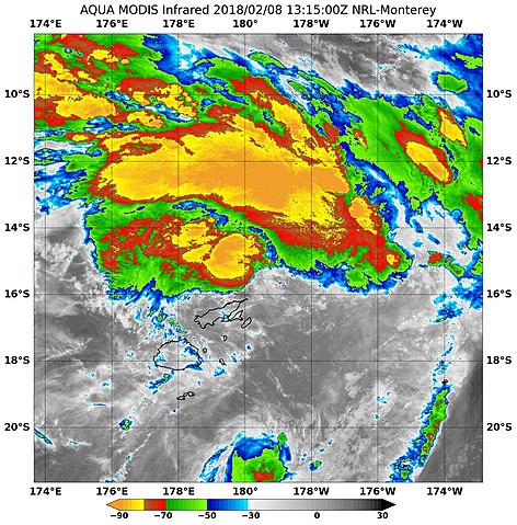
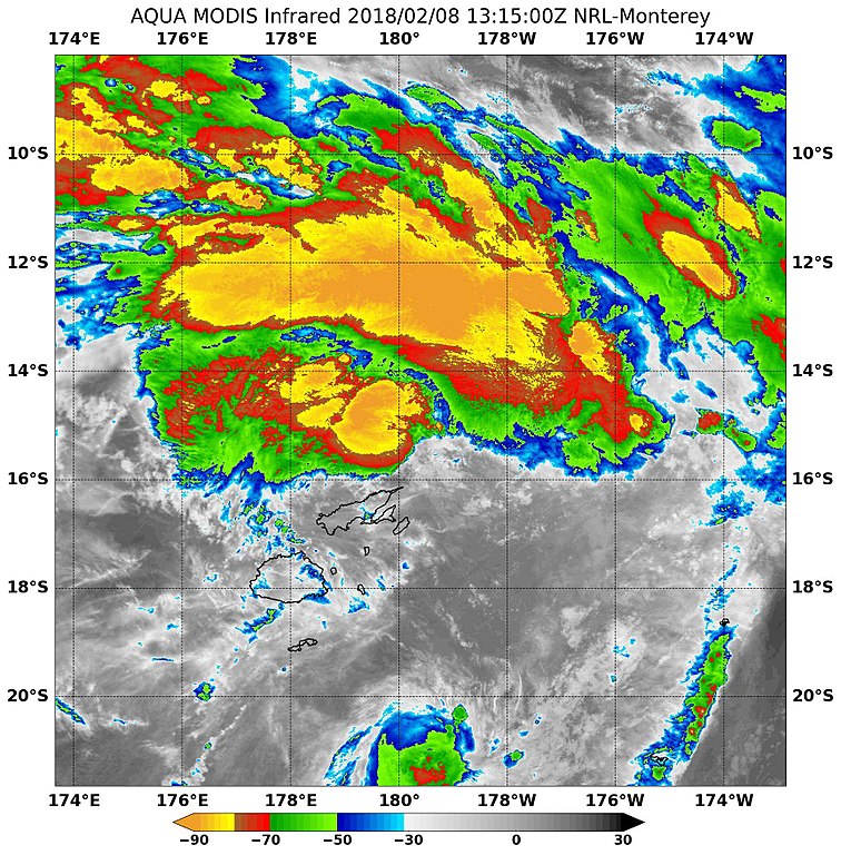
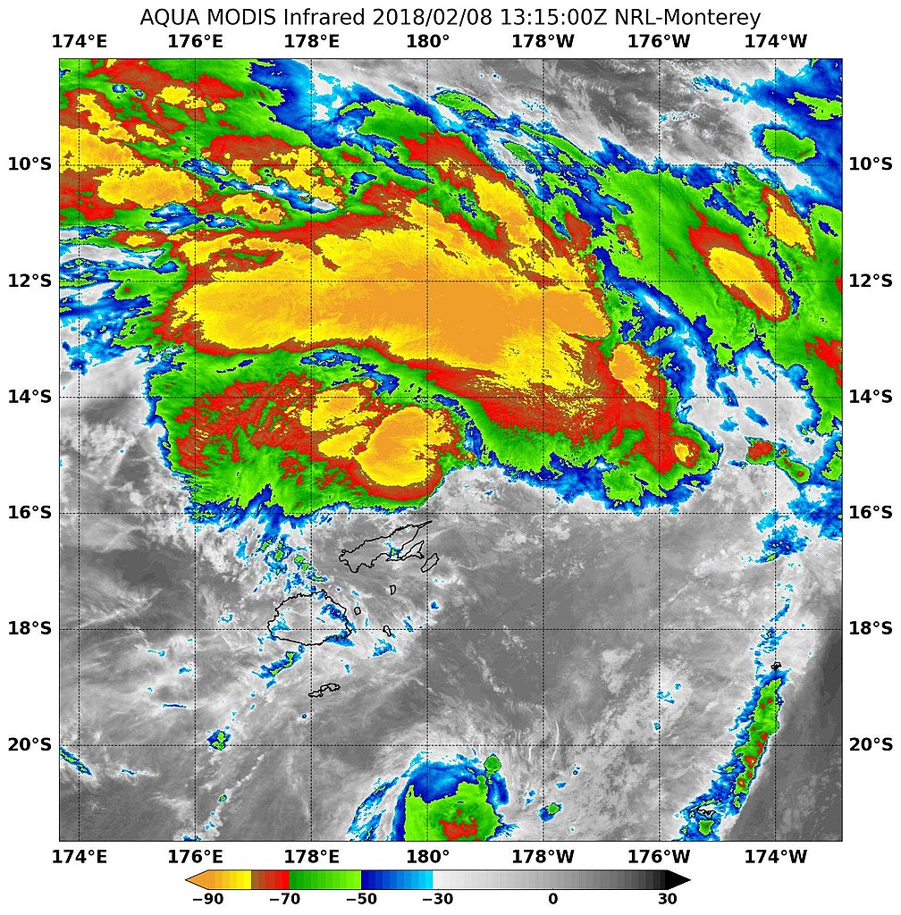
English: On Feb 8 the Moderate Resolution Imaging Spectroradiometer or MODIS instrument aboard NASA's Aqua satellite analyzed System 97P's cloud top temperatures in infrared light. MODIS found cloud top temperatures of strongest thunderstorms were as cold as or colder than minus 80 degrees Fahrenheit (minus 62.2 Celsius) in two areas, around the center and northeast of the center. Cloud top temperatures that cold indicate strong storms that have the capability to create heavy rain. |
| Date | |
| Source | https://www.facebook.com/NASAHurricane/photos/a.121853331194802.11206.112998395413629/1670427569670696/?type=3&theater |
| Author | NRL |
Licensing
edit
This file is a work of a sailor or employee of the U.S. Navy, taken or made as part of that person's official duties. As a work of the U.S. federal government, it is in the public domain in the United States.
|
 | |
| This file has been identified as being free of known restrictions under copyright law, including all related and neighboring rights. | ||
File history
Click on a date/time to view the file as it appeared at that time.
| Date/Time | Thumbnail | Dimensions | User | Comment | |
|---|---|---|---|---|---|
| current | 05:25, 3 April 2018 | | 1,726 × 1,754 (551 KB) | A1Cafel (talk | contribs) | User created page with UploadWizard |
You cannot overwrite this file.
File usage on Commons
There are no pages that use this file.