File:1274 Dampier Vander Spriet.jpg

Size of this preview: 800 × 530 pixels. Other resolutions: 320 × 212 pixels | 640 × 424 pixels | 1,024 × 679 pixels | 1,280 × 849 pixels | 2,560 × 1,697 pixels | 3,625 × 2,403 pixels.
Original file (3,625 × 2,403 pixels, file size: 4.7 MB, MIME type: image/jpeg)
Captions
Captions
Add a one-line explanation of what this file represents
Summary
edit
| Description |
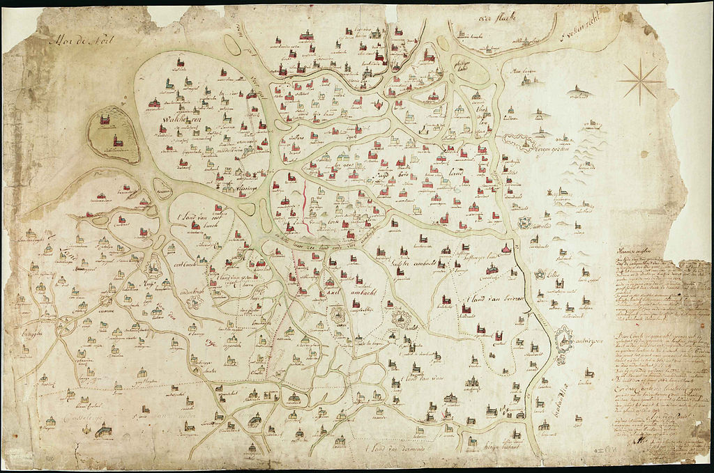
Nederlands: Kaarte van Zeeland en gedeelte van Vlaanderen zooals het was ten tijde van Guido van Dampier grave van Vlaanderen anno Christi MCCLXXIV English: Map of the area of Zeeland and Flanders just as it was at the time of Guido van Dampier. Engraved in Flanders in the Year of Our Lord MCCLXXIV |
| Date | |
| Source | aan elkaar geplakte screenshots van: http://mara.kbr.be/kbrImage/CM/1052434.imgf |
| Author | Spriet, A Vander |
| Size | 67x100 cm |
Zeeland, Vlaanderen
Licensing
edit
|
This work is in the public domain in its country of origin and other countries and areas where the copyright term is the author's life plus 100 years or fewer. | |
| This file has been identified as being free of known restrictions under copyright law, including all related and neighboring rights. | |
Kan niet correct zijn, in Antwerpen staat de citadel er al, die werd pas honderden jaren later door de Spanjaarden gebouwd..
File history
Click on a date/time to view the file as it appeared at that time.
| Date/Time | Thumbnail | Dimensions | User | Comment | |
|---|---|---|---|---|---|
| current | 14:33, 14 July 2010 | | 3,625 × 2,403 (4.7 MB) | Joop Rotte (talk | contribs) | {{Information |Description={{nl|1=Kaarte van Zeeland en gedeelte van Vlaanderen zooals het was ten tijde van Guido van Dampier grave van Vlaanderen anno Christi MCCLXXIV}} |Source=aan elkaar geplakte screenshots van: http://mara.kbr.be/kbrImage/CM/1052434 |
You cannot overwrite this file.
File usage on Commons
There are no pages that use this file.
File usage on other wikis
The following other wikis use this file:
- Usage on fr.wikipedia.org
- Usage on nl.wikipedia.org