File:14-26-00-fort-b-perches.jpg

Size of this preview: 800 × 210 pixels. Other resolutions: 320 × 84 pixels | 640 × 168 pixels | 1,024 × 269 pixels | 1,280 × 336 pixels | 2,560 × 671 pixels | 9,598 × 2,517 pixels.
Original file (9,598 × 2,517 pixels, file size: 29.17 MB, MIME type: image/jpeg)
Captions
Captions
Add a one-line explanation of what this file represents
Summary
edit| Description |
This file was uploaded with Commonist.
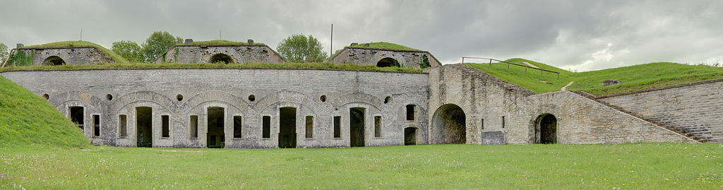
Fort des Basses Perches : vue sur le casernement principal Basses perches fortifications. |
||||||||||||||||||||||
| Date | |||||||||||||||||||||||
| Source | Own work | ||||||||||||||||||||||
| Author |
|
||||||||||||||||||||||


| Camera location | | View this and other nearby images on: OpenStreetMap |
|---|
Licensing
edit
This file is licensed under the Creative Commons Attribution 3.0 Unported license.
- You are free:
- to share – to copy, distribute and transmit the work
- to remix – to adapt the work
- Under the following conditions:
- attribution – You must give appropriate credit, provide a link to the license, and indicate if changes were made. You may do so in any reasonable manner, but not in any way that suggests the licensor endorses you or your use.
[[Category:Fort des Basses Perches]
File history
Click on a date/time to view the file as it appeared at that time.
| Date/Time | Thumbnail | Dimensions | User | Comment | |
|---|---|---|---|---|---|
| current | 09:26, 28 December 2011 | 9,598 × 2,517 (29.17 MB) | ComputerHotline (talk | contribs) | == {{int:filedesc}} == {{Information |Description={{Commonist}}{{Panorama}} Fort des Basses Perches : vue sur le casernement principal Basses perches fortifications. |Source={{own}} |Date=2010-08-12 |Author={{User:ComputerHotline/about}} |Permission= |o | |
| 08:19, 13 August 2010 | 9,598 × 2,517 (28.73 MB) | ComputerHotline (talk | contribs) |
You cannot overwrite this file.
File usage on Commons
The following 3 pages use this file:
File usage on other wikis
The following other wikis use this file:
- Usage on fr.wikipedia.org