File:1712 Basque districts.png
Size of this preview: 800 × 581 pixels. Other resolutions: 320 × 232 pixels | 640 × 465 pixels | 1,056 × 767 pixels.
Original file (1,056 × 767 pixels, file size: 1.96 MB, MIME type: image/png)
Captions
Captions
Add a one-line explanation of what this file represents
Summary edit
| Description |
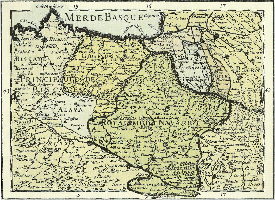
English: The Basque Country in early 18th century, as depicted by Charles Hubert Alexis Jaillot, French royal geographer |
| Date | |
| Source | Euskal Herria; Kartografian eta Testigantza Historikoetan |
| Author | Charles Hubert Alexis Jaillot |
Licensing edit
|
This work is in the public domain in its country of origin and other countries and areas where the copyright term is the author's life plus 100 years or fewer. | |
| This file has been identified as being free of known restrictions under copyright law, including all related and neighboring rights. | |
File history
Click on a date/time to view the file as it appeared at that time.
| Date/Time | Thumbnail | Dimensions | User | Comment | |
|---|---|---|---|---|---|
| current | 23:03, 6 September 2022 | | 1,056 × 767 (1.96 MB) | User-duck (talk | contribs) | Cropped background border using CropTool with lossless mode. |
| 13:54, 27 June 2014 |  | 1,090 × 812 (2.06 MB) | Iñaki LLM (talk | contribs) | User created page with UploadWizard |
You cannot overwrite this file.
File usage on Commons
There are no pages that use this file.
File usage on other wikis
The following other wikis use this file:
- Usage on en.wikipedia.org
- Usage on eu.wikipedia.org
- Usage on hr.wikipedia.org
- Usage on no.wikipedia.org
- Usage on sh.wikipedia.org
- Usage on sl.wikipedia.org