File:1762 map of the surroundings of Paris.jpg

Original file (6,080 × 4,268 pixels, file size: 6.18 MB, MIME type: image/jpeg)
Captions
Captions
Summary edit
| Title |
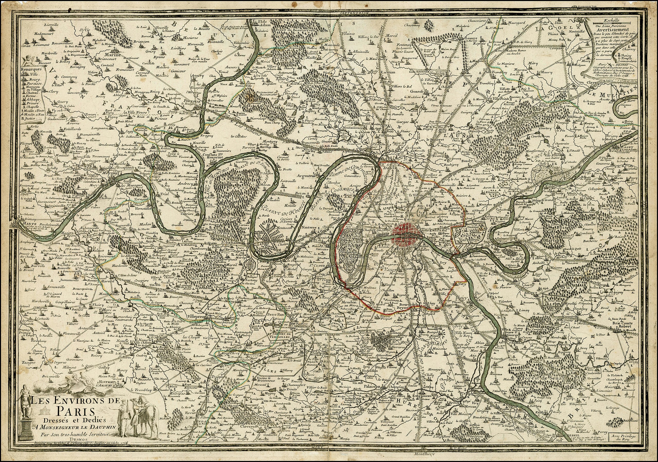
Les environs de Paris dressés et dédiés à Monseigneur le Dauphin |
| Description |
English: Detailed map of the Environs of Paris, originally published in 1690 by Nicolas De Fer, the Geographer to the King of France.
Fine map of the environs of Paris extending along the Seine from Mante in the west to Corbeil in the east, and extending northwards to the "Forest de Beaucarreau". The map depicts in fine detail the roads, boundaries and places of note - Versailles and the boundaries of the gardens and park well illustrated. The title cartouche, dedicating the map to the Dauphin, appears in the lower left corner and is illustrated with images of royal power and influence. This edition of the map was published by Charles Louis Desnos, who sucessor to the Nicolas De Fer's business, following the death of De Fer's son-in-law, Guillaume Danet. |
| Date | |
| Source | Barry Lawrence Ruderman Antique Maps Inc. |
| Creator |
Nicolas de Fer, Louis Charles Desnos |
| Geotemporal data | |
| Map location | Paris |
| Georeferencing | If inappropriate please set warp_status = skip to hide. |
| Archival data | |
| Collection | Barry Lawrence Ruderman Antique Maps Inc. |
| Dimensions | 30 x 20.5 inches |
Licensing edit
|
This work is in the public domain in its country of origin and other countries and areas where the copyright term is the author's life plus 70 years or fewer. This work is in the public domain in the United States because it was published (or registered with the U.S. Copyright Office) before January 1, 1929. | |
| This file has been identified as being free of known restrictions under copyright law, including all related and neighboring rights. | |
File history
Click on a date/time to view the file as it appeared at that time.
| Date/Time | Thumbnail | Dimensions | User | Comment | |
|---|---|---|---|---|---|
| current | 10:55, 19 April 2020 | | 6,080 × 4,268 (6.18 MB) | Balkanique (talk | contribs) | Uploaded a work by Nicolas de Fer / Louis Charles Desnos from https://www.raremaps.com/gallery/detail/26771/les-environs-de-paris-1766-de-fer-desnos with UploadWizard |
You cannot overwrite this file.
File usage on Commons
The following page uses this file:
File usage on other wikis
The following other wikis use this file:
- Usage on fr.wikipedia.org