File:1769 map of Eastern Europe by Tobias Conrad Lotter.jpg

Size of this preview: 800 × 390 pixels. Other resolutions: 320 × 156 pixels | 640 × 312 pixels | 1,024 × 499 pixels | 1,280 × 624 pixels | 2,560 × 1,248 pixels | 23,743 × 11,575 pixels.
Original file (23,743 × 11,575 pixels, file size: 34.34 MB, MIME type: image/jpeg)
Captions
Captions
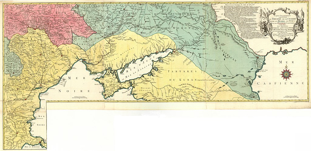
1769 map of Eastern Europe by Tobias Conrad Lotter
Summary
edit| Warning | The original file is very high-resolution. It might not load properly or could cause your browser to freeze when opened at full size. |
|---|
| Description |
English: 1769 map of Eastern Europe by Tobias Conrad Lotter
Français : Carte Geographique representant le Théatre de la Guerre entre les Russes les Turcs, et les Polonois Confédérés C'est à dire Les Provinces d'Ukrajine, de Nouvelle Servie de Moldavie, Valachie, Krimée, le Gouvernement de Woronez et d'Astracan comme aussi la Tartarie de Kuban. Par Tobie Conrad Lotter, Geogr. à Augsbourg ; Gravé par les G. F. et G.C. Lotter les fils |
||||||||||||||||||||||
| Date | |||||||||||||||||||||||
| Source | https://mapy.mzk.cz/de/mzk03/001/053/414/2619316906/ | ||||||||||||||||||||||
| Author |
|
||||||||||||||||||||||
| Other versions | |||||||||||||||||||||||

Licensing
edit
|
This work is in the public domain in its country of origin and other countries and areas where the copyright term is the author's life plus 70 years or fewer. This work is in the public domain in the United States because it was published (or registered with the U.S. Copyright Office) before January 1, 1929. | |
| This file has been identified as being free of known restrictions under copyright law, including all related and neighboring rights. | |
File history
Click on a date/time to view the file as it appeared at that time.
| Date/Time | Thumbnail | Dimensions | User | Comment | |
|---|---|---|---|---|---|
| current | 21:10, 15 March 2020 | | 23,743 × 11,575 (34.34 MB) | Balkanique (talk | contribs) | Uploaded a work by Autor: Lotter, Tobias Conrad, 1717-1777 from https://mapy.mzk.cz/de/mzk03/001/053/414/2619316906/ with UploadWizard |
You cannot overwrite this file.
File usage on Commons
The following 3 pages use this file:
File usage on other wikis
The following other wikis use this file:
- Usage on ru.wikipedia.org
- Usage on sh.wikipedia.org