File:1772 map of Paris by Louis Charles Desnos.jpg

Size of this preview: 800 × 448 pixels. Other resolutions: 320 × 179 pixels | 640 × 359 pixels | 1,024 × 574 pixels | 1,280 × 717 pixels | 2,560 × 1,435 pixels | 7,982 × 4,473 pixels.
Original file (7,982 × 4,473 pixels, file size: 8.62 MB, MIME type: image/jpeg)
Captions
Captions
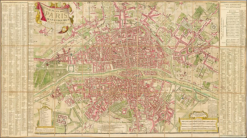
1772 map of Paris by Louis Charles Desnos
Summary
edit
| Title |
Nouveau Plan de Paris, ses faubourgs et ses environs |
||||||||||||||||
| Description |
English: Decorative large format plan of Paris, showing a highly detailed treatment of the City in the middle of the 18th Century.
The map includes a decorative cartouche and is highly embellished and full of detail. |
||||||||||||||||
| Date | |||||||||||||||||
| Source | Barry Lawrence Ruderman Antique Maps Inc. | ||||||||||||||||
| Creator |
|
||||||||||||||||
| Geotemporal data | |||||||||||||||||
| Date depicted | |||||||||||||||||
| Map location | Paris | ||||||||||||||||
| Georeferencing | If inappropriate please set warp_status = skip to hide. | ||||||||||||||||
| Archival data | |||||||||||||||||
| Dimensions | 37 x 21 inches | ||||||||||||||||
| Medium | Hand Colored | ||||||||||||||||
Licensing
edit
|
This work is in the public domain in its country of origin and other countries and areas where the copyright term is the author's life plus 100 years or fewer. This work is in the public domain in the United States because it was published (or registered with the U.S. Copyright Office) before January 1, 1929. | |
| This file has been identified as being free of known restrictions under copyright law, including all related and neighboring rights. | |
File history
Click on a date/time to view the file as it appeared at that time.
| Date/Time | Thumbnail | Dimensions | User | Comment | |
|---|---|---|---|---|---|
| current | 11:05, 19 April 2020 | | 7,982 × 4,473 (8.62 MB) | Balkanique (talk | contribs) | Uploaded a work by Louis Charles Desnos from https://www.raremaps.com/gallery/detail/35835/nouveau-plan-de-paris-ses-faubourgs-et-ses-environs-17-desnos with UploadWizard |
You cannot overwrite this file.
File usage on Commons
The following page uses this file: