File:1795 Bowles Pocket Map of London - Geographicus - London-bowles-1795.jpg

Size of this preview: 800 × 570 pixels. Other resolutions: 320 × 228 pixels | 640 × 456 pixels | 1,024 × 730 pixels | 1,280 × 913 pixels | 2,560 × 1,825 pixels | 4,000 × 2,852 pixels.
Original file (4,000 × 2,852 pixels, file size: 4.33 MB, MIME type: image/jpeg)
Captions
Captions
Add a one-line explanation of what this file represents
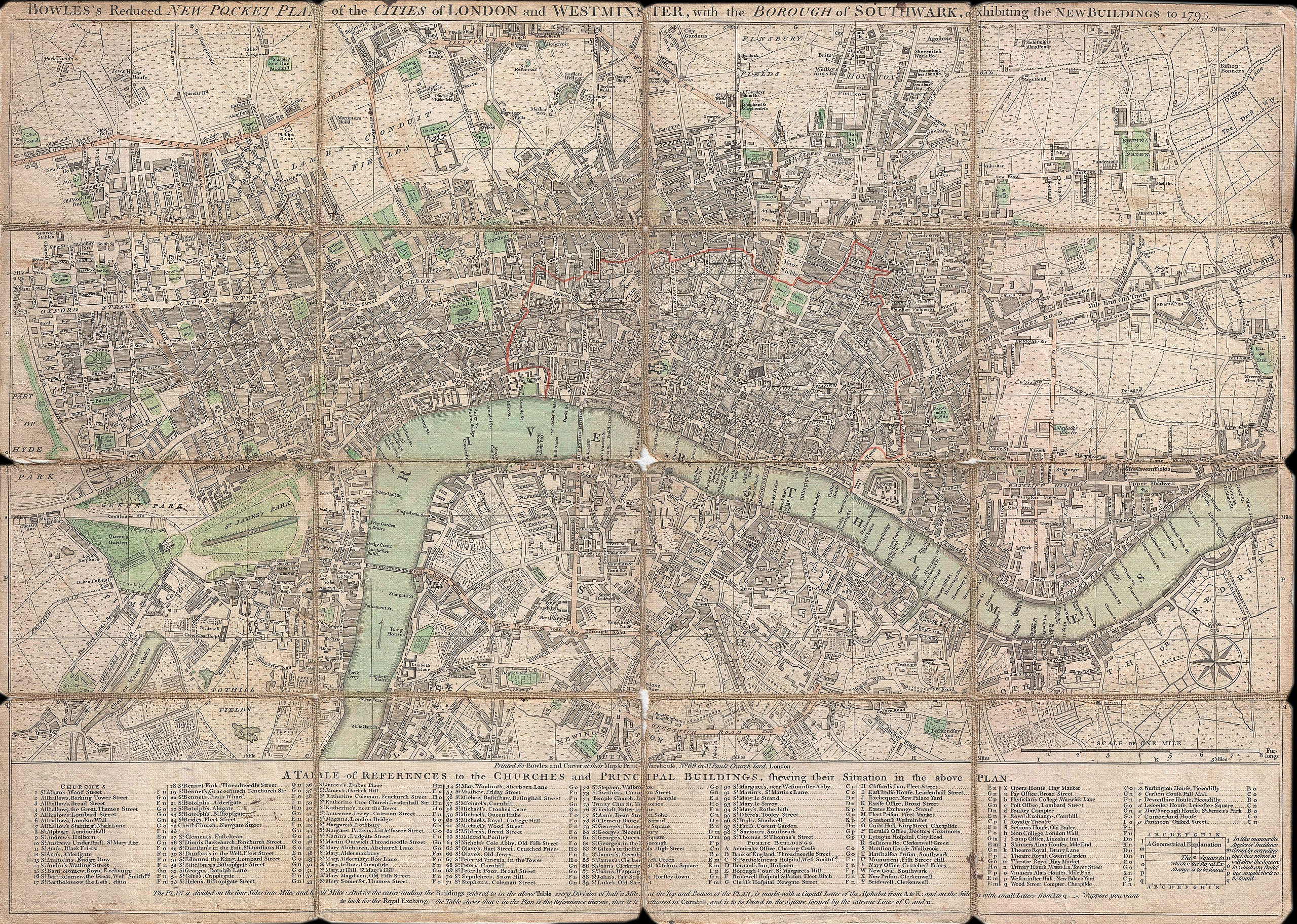
| BOWLES'S Reduced NEW POCKET PLAN of the CITIES of LONDON and WESTMINSTER, with the BOROUGH of SOUTHWARK, exhibiting the NEW BUILDINGS to the YEAR 1795. | ||||||
|---|---|---|---|---|---|---|
| Artist | ||||||
| Title |
BOWLES'S Reduced NEW POCKET PLAN of the CITIES of LONDON and WESTMINSTER, with the BOROUGH of SOUTHWARK, exhibiting the NEW BUILDINGS to the YEAR 1795. |
|||||
| Description |
English: This is a rare 1795 folding pocket map or street plan of London, England by Carrington Bowles. Covers London on both sides of the Thames River from Hyde Park in the west to White Horse Street in the East and from Lambeth in the south to Islington in the North. Offers superb detail throughout often noting individual buildings, gardens, and estates. Table along the bottom notes principle buildings and churches. Bowles first issued this plan in 1777 and updated it regularly to the end of the 18th century. This edition of the map was issued shortly after Bowles's death by his firm, Bowles and Carver, from their offices at No. 69 St. Paul's Church Yard, London. |
|||||
| Date | 1795 (dated) | |||||
| Dimensions | height: 15.5 in (39.3 cm); width: 21.7 in (55.2 cm) | |||||
| Accession number |
Geographicus link: London-bowles-1795 |
|||||
| Source/Photographer |
|
|||||
| Permission (Reusing this file) |
|
|||||
File history
Click on a date/time to view the file as it appeared at that time.
| Date/Time | Thumbnail | Dimensions | User | Comment | |
|---|---|---|---|---|---|
| current | 01:40, 23 March 2011 | | 4,000 × 2,852 (4.33 MB) | BotMultichillT (talk | contribs) | {{subst:User:Multichill/Geographicus |link=http://www.geographicus.com/P/AntiqueMap/London-bowles-1795 |product_name=1795 Bowles Pocket Map of London |map_title=BOWLES'S Reduced NEW POCKET PLAN of the CITIES of LONDON and WESTMINSTER, with the BOROUGH of |
You cannot overwrite this file.
File usage on Commons
The following page uses this file: