File:1796 blackriverOuachita.jpg
Size of this preview: 450 × 600 pixels. Other resolutions: 180 × 240 pixels | 360 × 480 pixels | 576 × 768 pixels | 768 × 1,024 pixels | 1,536 × 2,048 pixels | 3,120 × 4,160 pixels.
Original file (3,120 × 4,160 pixels, file size: 2.22 MB, MIME type: image/jpeg)
Captions
Captions
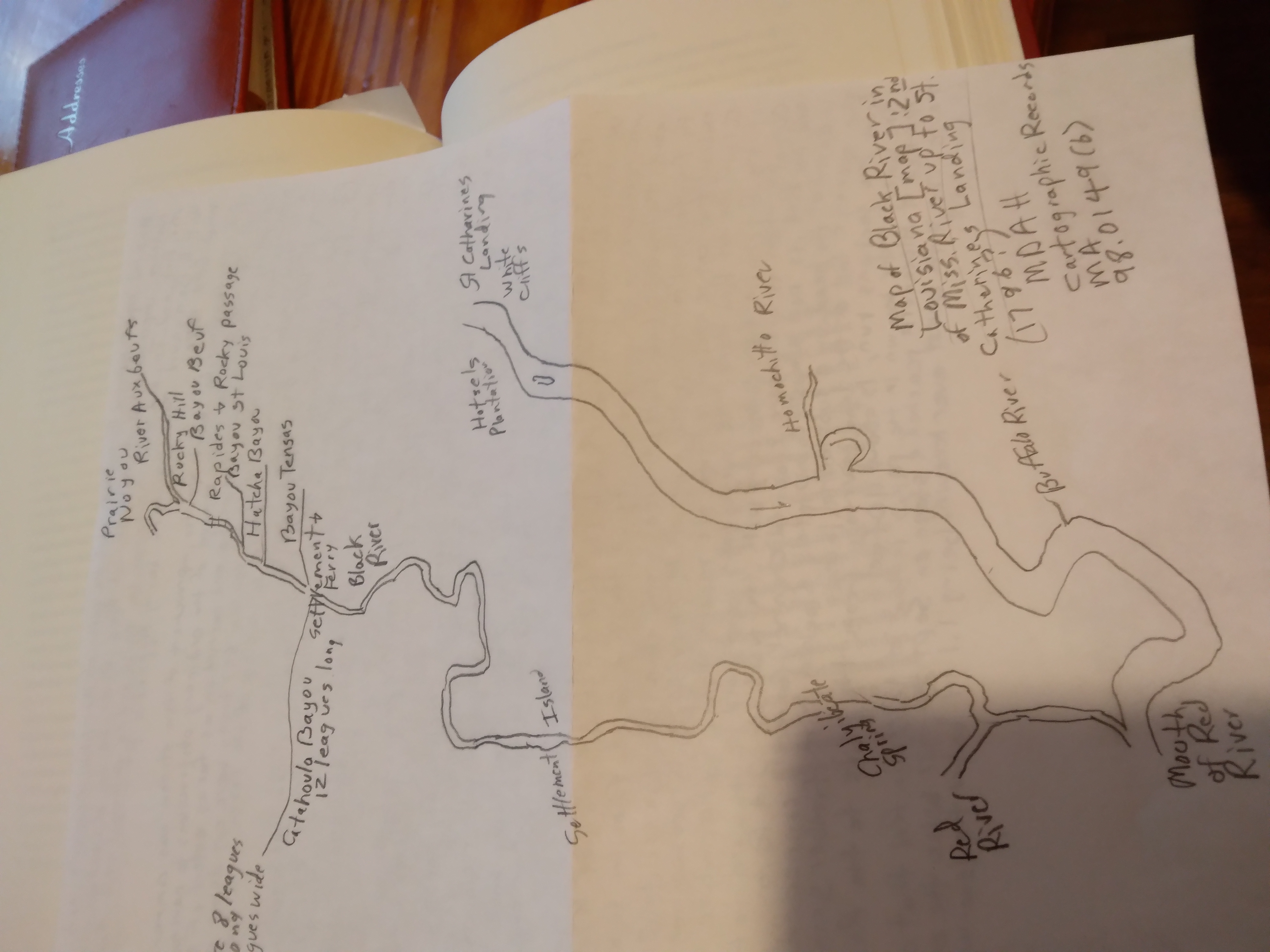
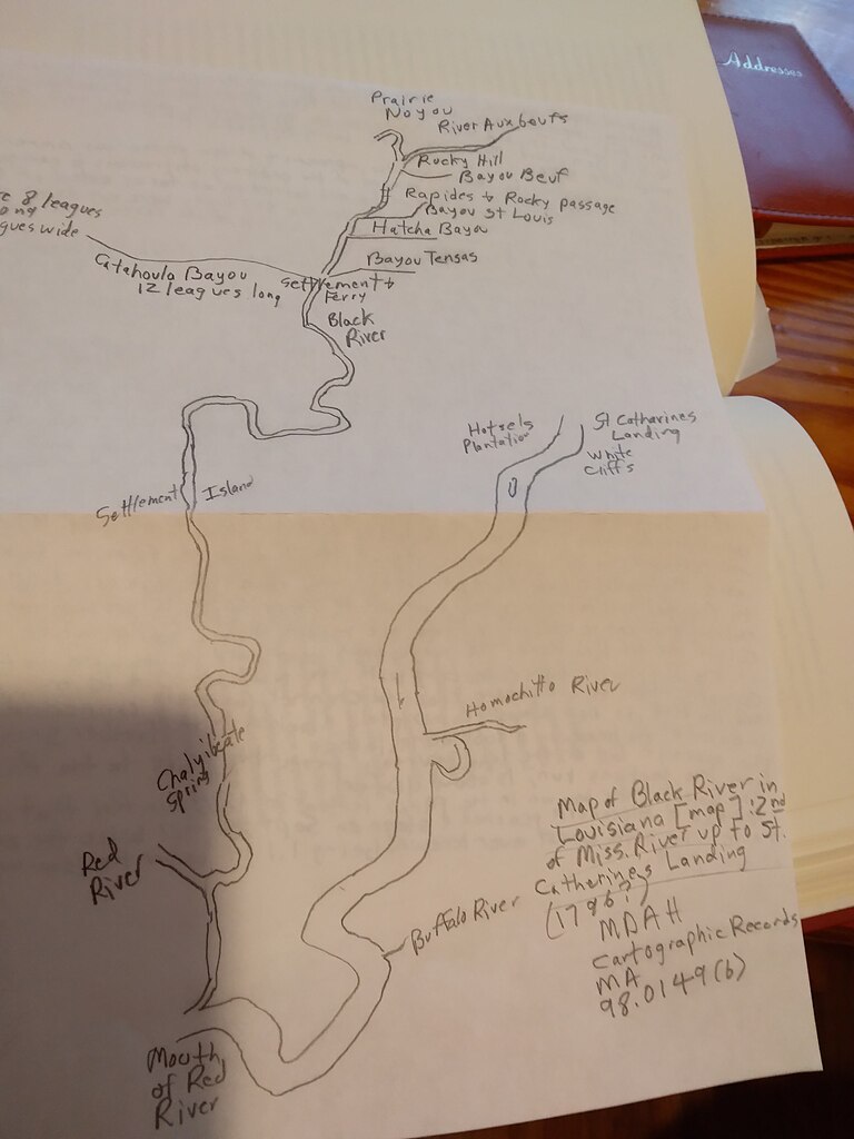
Map of Black River, Louisiana
Summary edit
| Description |
English: Personal sketch of a holding of the Mississippi Department of Archives & History; call no MA 98.0149 (b) |
| Date | |
| Source | Own work |
| Author | Comingdeer |
| Camera location | | View this and other nearby images on: OpenStreetMap |
|---|
unknown creator
Licensing edit
I, the copyright holder of this work, hereby publish it under the following license:
This file is licensed under the Creative Commons Attribution-Share Alike 4.0 International license.
- You are free:
- to share – to copy, distribute and transmit the work
- to remix – to adapt the work
- Under the following conditions:
- attribution – You must give appropriate credit, provide a link to the license, and indicate if changes were made. You may do so in any reasonable manner, but not in any way that suggests the licensor endorses you or your use.
- share alike – If you remix, transform, or build upon the material, you must distribute your contributions under the same or compatible license as the original.
File history
Click on a date/time to view the file as it appeared at that time.
| Date/Time | Thumbnail | Dimensions | User | Comment | |
|---|---|---|---|---|---|
| current | 16:16, 10 December 2021 | | 3,120 × 4,160 (2.22 MB) | Comingdeer (talk | contribs) | Uploaded own work with UploadWizard |
You cannot overwrite this file.
File usage on Commons
There are no pages that use this file.