File:1827 Finley Map of Scotland - Geographicus - Scotland-finley-1827.jpg
Size of this preview: 465 × 599 pixels. Other resolutions: 186 × 240 pixels | 372 × 480 pixels | 596 × 768 pixels | 794 × 1,024 pixels | 2,327 × 3,000 pixels.
Original file (2,327 × 3,000 pixels, file size: 2.1 MB, MIME type: image/jpeg)
Captions
Captions
Add a one-line explanation of what this file represents
| Anthony Finley: Scotland.
( |
||||||||||||||
|---|---|---|---|---|---|---|---|---|---|---|---|---|---|---|
| Artist |
|
|||||||||||||
| Title |
Scotland. |
|||||||||||||
| Description |
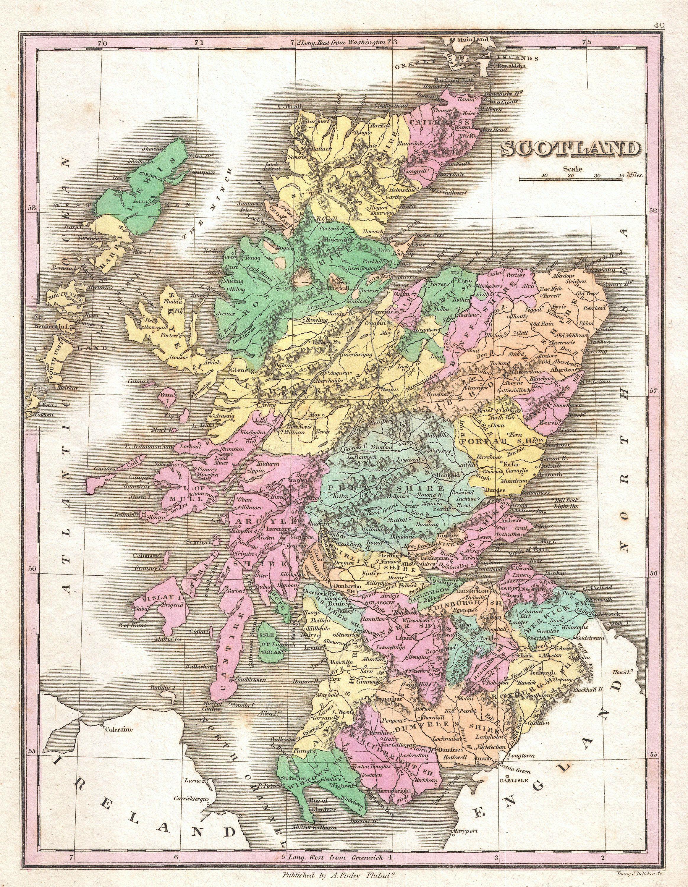
English: This is Finley’s desirable 1827 map of Scotland. Shows river ways, roads, canals, and some topographical features. Color coding defines traditional county divisions. Mile scales and title in upper right quadrant. Engraved by Young and Delleker for the 1827 edition of Anthony Finley's General Atlas . |
|||||||||||||
| Date | 1827 (undated) | |||||||||||||
| Dimensions | height: 11.5 in (29.2 cm); width: 9 in (22.8 cm) | |||||||||||||
| Accession number |
Geographicus link: Scotland-finley-1827 |
|||||||||||||
| Source/Photographer |
Finley, Anthony, A New General Altas, Comprising a Complete Set of Maps, representing the Grand Divisions of the Globe, Together with the several Empires, Kingdoms and States in the World; Compiled from the Best Authorities, and corrected by the Most Recent Discoveries, Philadelphia, 1827.
|
|||||||||||||
| Permission (Reusing this file) |
|
|||||||||||||
File history
Click on a date/time to view the file as it appeared at that time.
| Date/Time | Thumbnail | Dimensions | User | Comment | |
|---|---|---|---|---|---|
| current | 09:15, 23 March 2011 | | 2,327 × 3,000 (2.1 MB) | BotMultichillT (talk | contribs) | {{subst:User:Multichill/Geographicus |link=http://www.geographicus.com/P/AntiqueMap/Scotland-finley-1827 |product_name=1827 Finley Map of Scotland |map_title=Scotland. |description=This is Finley’s desirable 1827 map of Scotland. Shows river ways, road |
You cannot overwrite this file.
File usage on Commons
The following page uses this file: