File:1838 Southern New England railroad map.jpg
Size of this preview: 709 × 600 pixels. Other resolutions: 284 × 240 pixels | 567 × 480 pixels | 908 × 768 pixels | 1,210 × 1,024 pixels | 2,420 × 2,048 pixels | 7,204 × 6,096 pixels.
Original file (7,204 × 6,096 pixels, file size: 39.17 MB, MIME type: image/jpeg)
Captions
Captions
Add a one-line explanation of what this file represents
| Description |
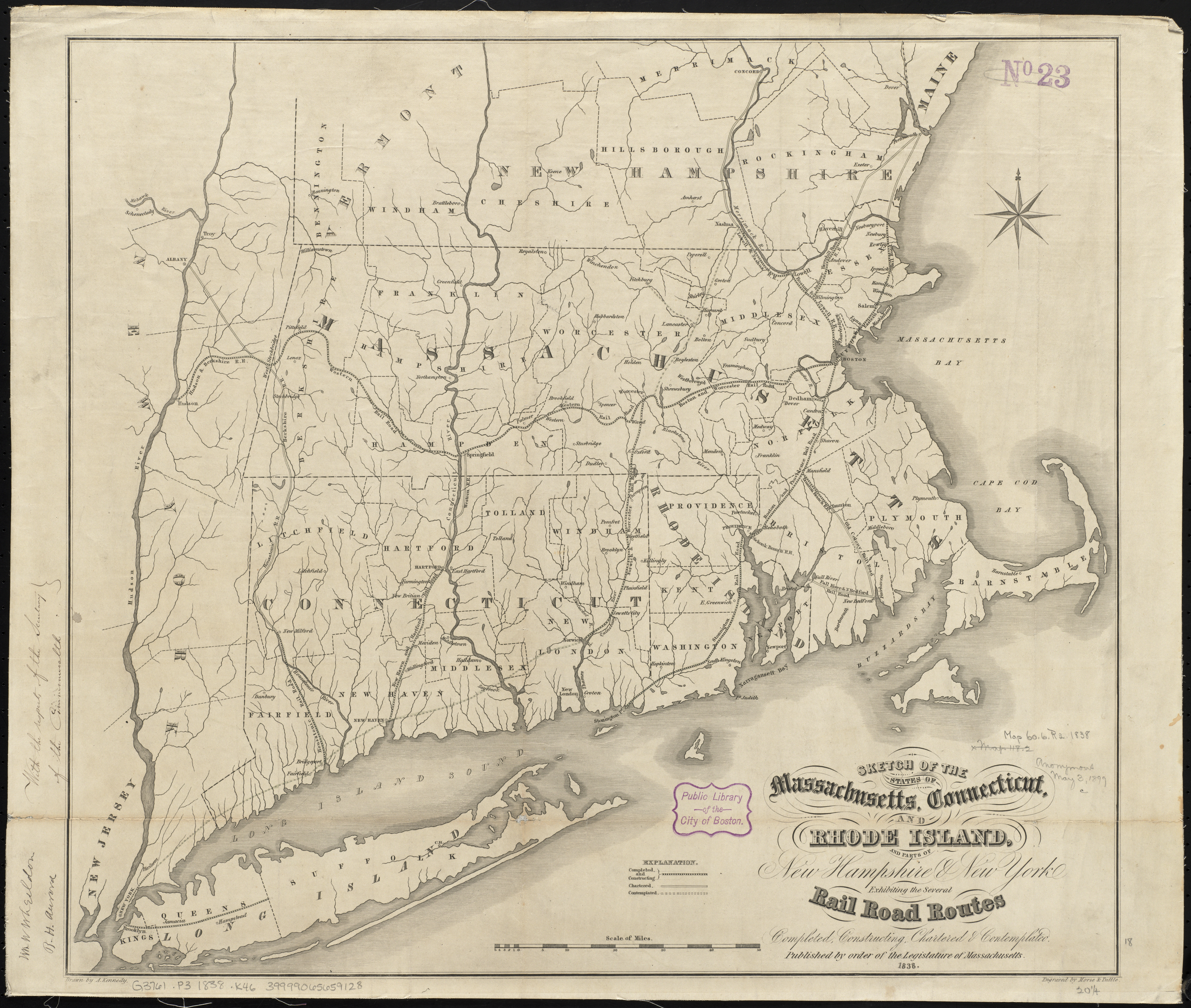
English: 1838 map of southern New England showing existing railroad lines as well as those under construction, chartered but not yet under construction, and proposed but not yet chartered. |
||
| Date | |||
| Source | Sketch of the states of Massachusetts, Connecticut, and Rhode Island, and parts of New Hampshire & New York exhibiting the several rail road routes completed, constructing, chartered & contemplated via Norman B. Leventhal Map Center | ||
| Author | Archibald Kennedy | ||
| Permission (Reusing this file) |
|
File history
Click on a date/time to view the file as it appeared at that time.
| Date/Time | Thumbnail | Dimensions | User | Comment | |
|---|---|---|---|---|---|
| current | 20:04, 8 September 2015 | | 7,204 × 6,096 (39.17 MB) | Pi.1415926535 (talk | contribs) | {{Information |Description ={{en|1=1838 map of southern New England showing existing railroad lines as well as those under construction, chartered but not yet under construction, and proposed but not yet chartered.}} |Source =[http://maps.bp... |
You cannot overwrite this file.
File usage on Commons
The following 2 pages use this file: