File:1842TreatyOfLaPointe.jpg
Size of this preview: 800 × 582 pixels. Other resolutions: 320 × 233 pixels | 640 × 465 pixels | 1,024 × 745 pixels | 1,280 × 931 pixels | 1,650 × 1,200 pixels.
Original file (1,650 × 1,200 pixels, file size: 1.2 MB, MIME type: image/jpeg)
Captions
Captions
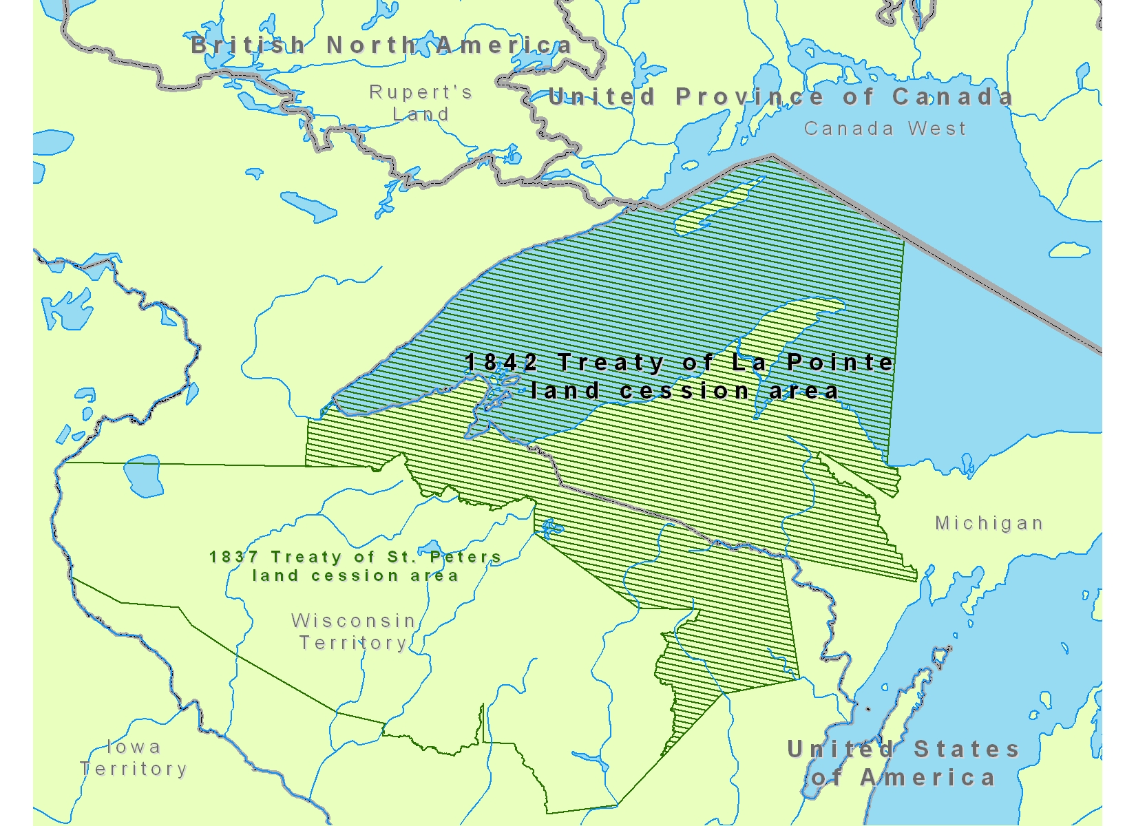
Map is incorrect. East boundary is straight line from Big Island at Mouth of Eacanaba River to Head Water of Chocolay. Not as described in 1836 Treaty.
Summary
edit
| Description |
English: Map of Lake Superior region showing the 1842 Treaty of La Pointe land cession area of Native American tribal territories.
|
| Date | |
| Source | Own work |
| Author | CJLippert |
Licensing
edit
| I, the copyright holder of this work, release this work into the public domain. This applies worldwide. In some countries this may not be legally possible; if so: I grant anyone the right to use this work for any purpose, without any conditions, unless such conditions are required by law. |
File history
Click on a date/time to view the file as it appeared at that time.
| Date/Time | Thumbnail | Dimensions | User | Comment | |
|---|---|---|---|---|---|
| current | 18:36, 22 August 2008 | | 1,650 × 1,200 (1.2 MB) | CJLippert (talk | contribs) | {{Information |Description={{en|1=Map of Lake Superior region showing the 1842 Treaty of La Pointe land cession area in reference to Rupert's Land, Canada West, [[w:Michig |
You cannot overwrite this file.
File usage on Commons
There are no pages that use this file.
File usage on other wikis
The following other wikis use this file:
- Usage on en.wikipedia.org
- Usage on fr.wikipedia.org
- Usage on fy.wikipedia.org
- Usage on ro.wikipedia.org
- Usage on ru.wikipedia.org