File:1846 Oregon territory.jpg

Size of this preview: 662 × 600 pixels. Other resolutions: 265 × 240 pixels | 530 × 480 pixels | 848 × 768 pixels | 1,130 × 1,024 pixels | 2,218 × 2,010 pixels.
Original file (2,218 × 2,010 pixels, file size: 1,021 KB, MIME type: image/jpeg)
Captions
Captions
Add a one-line explanation of what this file represents
Summary edit
| Description |
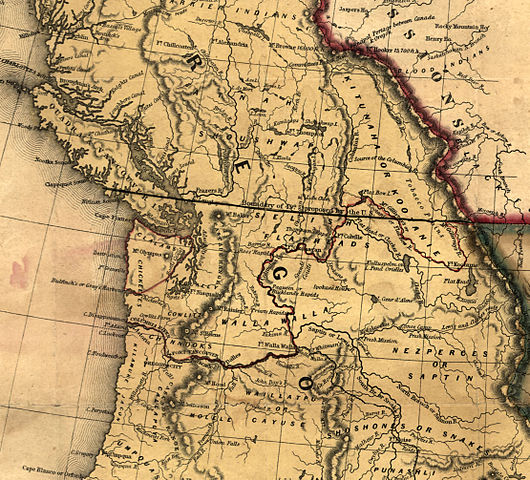
English: Map showing the 49th Parallel drawn through Vancouver Island as the boundary between US and British territory. |
| Date | |
| Source | http://hdl.loc.gov/loc.gmd/g4050.ct000603 |
| Author | Unknown author |

|
This map is available from the United States Library of Congress's Geography & Map Division
under the digital ID g4050.ct000603. This tag does not indicate the copyright status of the attached work. A normal copyright tag is still required. See Commons:Licensing.
|
Licensing edit
|
This work is in the public domain in its country of origin and other countries and areas where the copyright term is the author's life plus 100 years or fewer. This work is in the public domain in the United States because it was published (or registered with the U.S. Copyright Office) before January 1, 1929. | |
| This file has been identified as being free of known restrictions under copyright law, including all related and neighboring rights. | |
File history
Click on a date/time to view the file as it appeared at that time.
| Date/Time | Thumbnail | Dimensions | User | Comment | |
|---|---|---|---|---|---|
| current | 13:40, 7 April 2011 | | 2,218 × 2,010 (1,021 KB) | Lumu (talk | contribs) | full resolution |
| 22:28, 10 April 2006 |  | 392 × 424 (60 KB) | Roke~commonswiki (talk | contribs) | From [http://memory.loc.gov/cgi-bin/query/r?ammem/gmd:@field(NUMBER+@band(g4050+ct000603))] Category: Historical maps of Canada {{PD-US}} |
You cannot overwrite this file.
File usage on Commons
There are no pages that use this file.
File usage on other wikis
The following other wikis use this file:
- Usage on de.wikipedia.org
- Usage on en.wikipedia.org
- Usage on ja.wikipedia.org
- Usage on nl.wikipedia.org
- Usage on ru.wikipedia.org