File:1846 map - Europaeische Türkey, Griechenland und die Ionischen Inseln.tif

Size of this JPG preview of this TIF file: 512 × 600 pixels. Other resolutions: 205 × 240 pixels | 410 × 480 pixels | 656 × 768 pixels | 874 × 1,024 pixels | 1,748 × 2,048 pixels | 5,398 × 6,323 pixels.
Original file (5,398 × 6,323 pixels, file size: 80.02 MB, MIME type: image/tiff)
Captions
Captions
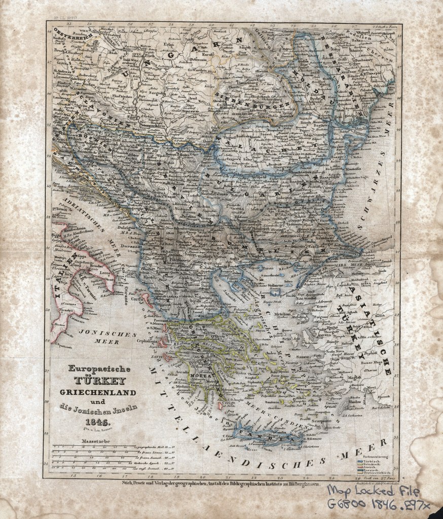
1846 map of Turkey in Europe, Greece and the Ionian Islands
Summary
edit| Description |
English: 1846 map of Turkey in Europe, Greece and the Ionian Islands |
| Date | |
| Source | Internet Archive identifier: europaeischetrke00 |
| Author |
"Stich, Druck und Verlag der geographischen Austalt des Bibliographischen Instituts zu Hildburghausen." Engraved by a Prussian Lieutenant Renner Originally from "Meyer's Conversations Lexicon" |
Licensing
edit|
This work is in the public domain in its country of origin and other countries and areas where the copyright term is the author's life plus 70 years or fewer. This work is in the public domain in the United States because it was published (or registered with the U.S. Copyright Office) before January 1, 1929. | |
| This file has been identified as being free of known restrictions under copyright law, including all related and neighboring rights. | |
File history
Click on a date/time to view the file as it appeared at that time.
| Date/Time | Thumbnail | Dimensions | User | Comment | |
|---|---|---|---|---|---|
| current | 18:53, 9 March 2019 |  | 5,398 × 6,323 (80.02 MB) | Balkanique (talk | contribs) | User created page with UploadWizard |
You cannot overwrite this file.
File usage on Commons
The following page uses this file: