File:1851 Rees map of Chicagoland.jpg

Original file (12,494 × 13,272 pixels, file size: 28.13 MB, MIME type: image/jpeg)
Captions
Captions
| Warning | The original file is very high-resolution. It might not load properly or could cause your browser to freeze when opened at full size. |
|---|
| Title |
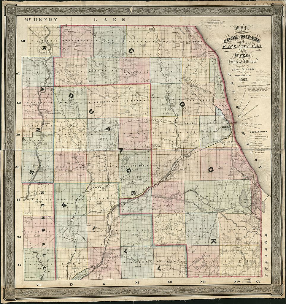
English: Map of the Counties of Cook and DuPage, the east part of Kane and Kendall, the north part of Will, state of Illinois |
|||||||||||||||||||||||
| Date | ||||||||||||||||||||||||
| Source |
|
|||||||||||||||||||||||
| Creator |
Rees, James H.; Ferd. Mayer & Co. |
|||||||||||||||||||||||
| Permission (Reusing this file) |
|
|||||||||||||||||||||||
| Geotemporal data | ||||||||||||||||||||||||
| Date depicted | ||||||||||||||||||||||||
| Map location | Chicago | |||||||||||||||||||||||
| Bounding box |
|
|||||||||||||||||||||||
| Georeferencing | ||||||||||||||||||||||||
| Bibliographic data | ||||||||||||||||||||||||
| Publisher |
Chicago, Ill. : James H. Rees, 1851. |
|||||||||||||||||||||||
| Archival data | ||||||||||||||||||||||||
| Dimensions | 100 × 95 cm (39.3 × 37.4 in) | |||||||||||||||||||||||
| Other versions | https://www.loc.gov/item/2013593073/ | |||||||||||||||||||||||

File history
Click on a date/time to view the file as it appeared at that time.
| Date/Time | Thumbnail | Dimensions | User | Comment | |
|---|---|---|---|---|---|
| current | 20:35, 11 August 2016 | | 12,494 × 13,272 (28.13 MB) | Scewing (talk | contribs) | {{Map |title ={{en|Map of the Counties of Cook and DuPage, the east part of Kane and Kendall, the north part of Will, state of Illinois}} |description = |legend = |author =Rees, James H.; Ferd. Mayer & Co. |date... |
You cannot overwrite this file.
File usage on Commons
The following page uses this file: