File:1865 Spruner Map of Southern Italy and Sicily - Geographicus - ItaliaeSicilia-spruner-1865.jpg
Size of this preview: 493 × 600 pixels. Other resolutions: 197 × 240 pixels | 394 × 480 pixels | 631 × 768 pixels | 842 × 1,024 pixels | 1,683 × 2,048 pixels | 2,877 × 3,500 pixels.
Original file (2,877 × 3,500 pixels, file size: 2.35 MB, MIME type: image/jpeg)
Captions
Captions
Add a one-line explanation of what this file represents
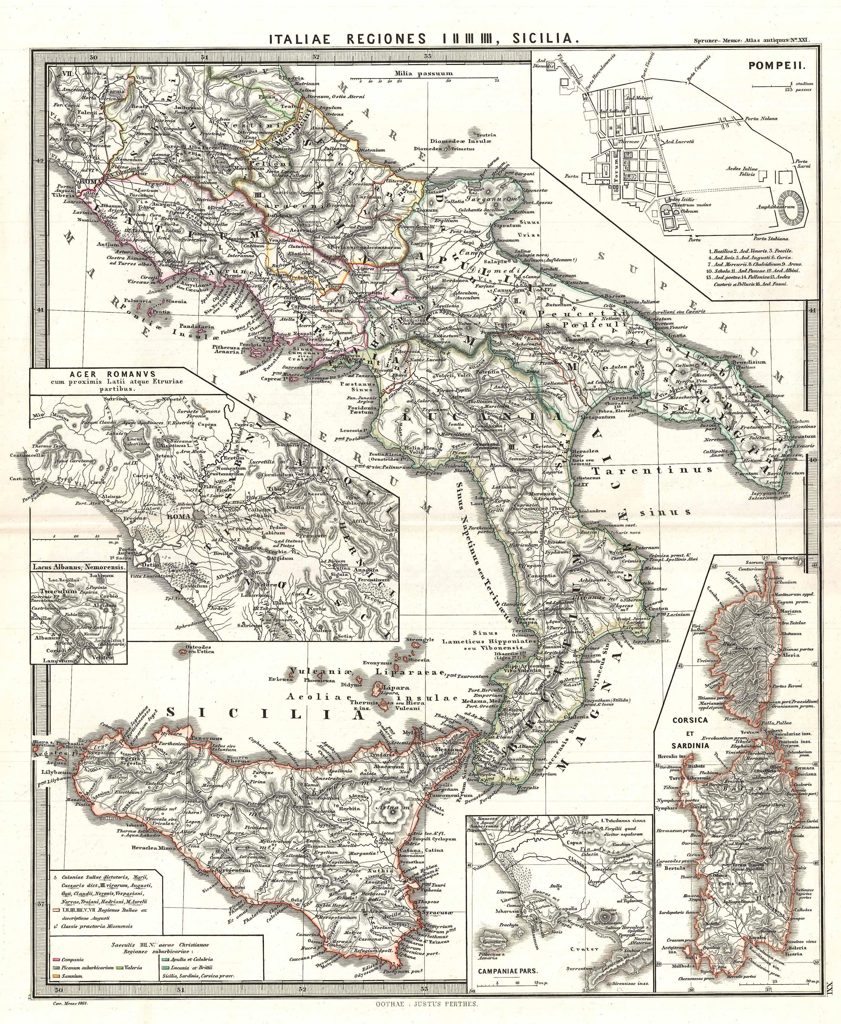
| Karl Spruner von Merz: Italiae regiones I II III IIII, Sicilia.
( |
||||||||||||||||||||
|---|---|---|---|---|---|---|---|---|---|---|---|---|---|---|---|---|---|---|---|---|
| Artist |
|
|||||||||||||||||||
| Title |
Italiae regiones I II III IIII, Sicilia. |
|||||||||||||||||||
| Description |
English: A particularly interesting map, this is Karl von Spruner’s 1865 rendering of Southern Italy and Sicily in antiquity. This map covers southern Italy from Rome south as far as modern day Naples and Sicily, and east as far as Calabria. Like most of Spruner’s work this example overlays ancient political geographies on relatively contemporary physical geographies, thus identifying the sites of forgotten towns and villages, the movements of armies, and the disposition of lands in the region. This particular example includes ancient names for many notable regions and historical sites. Additionally, there are a total of five insets (clockwise from top right): Pompeii, Corsica and Sardinia, Campaniae Pars, Lacus Albanus, and Ager Romanus (vicinity of Rome). As a whole the map labels important cities, rivers, mountain ranges and other minor topographical detail. Territories and countries outlined in color. The whole is rendered in finely engraved detail exhibiting the fine craftsmanship for which the Perthes firm is known. |
|||||||||||||||||||
| Date | 1865 (undated) | |||||||||||||||||||
| Dimensions | height: 16 in (40.6 cm); width: 13 in (33 cm) | |||||||||||||||||||
| Accession number |
Geographicus link: ItaliaeSicilia-spruner-1865 |
|||||||||||||||||||
| Source/Photographer |
Spruner, Karl von, Spruner-Menke Atlas Antiquus,, (Gotha: Justus Perthes), 1865.
|
|||||||||||||||||||
| Permission (Reusing this file) |
|
|||||||||||||||||||
File history
Click on a date/time to view the file as it appeared at that time.
| Date/Time | Thumbnail | Dimensions | User | Comment | |
|---|---|---|---|---|---|
| current | 06:08, 25 March 2011 | | 2,877 × 3,500 (2.35 MB) | BotMultichillT (talk | contribs) | {{subst:User:Multichill/Geographicus |link=http://www.geographicus.com/P/AntiqueMap/ItaliaeSicilia-spruner-1865 |product_name=1865 Spruner Map of Southern Italy and Sicily |map_title=Italiae regiones I II III IIII, Sicilia. |description=A particularly int |
You cannot overwrite this file.
File usage on Commons
The following page uses this file: