File:19°S-MP0001299.pdf

Size of this JPG preview of this PDF file: 800 × 573 pixels. Other resolutions: 320 × 229 pixels | 640 × 458 pixels | 1,024 × 733 pixels | 1,280 × 917 pixels | 2,560 × 1,833 pixels | 4,468 × 3,200 pixels.
Original file (4,468 × 3,200 pixels, file size: 2.27 MB, MIME type: application/pdf)
Captions
Captions
Add a one-line explanation of what this file represents
Summary edit
| Description |
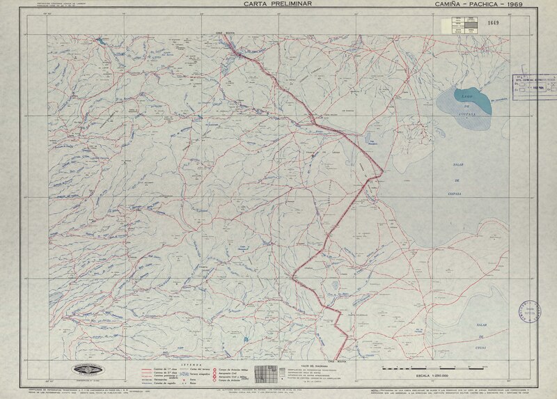
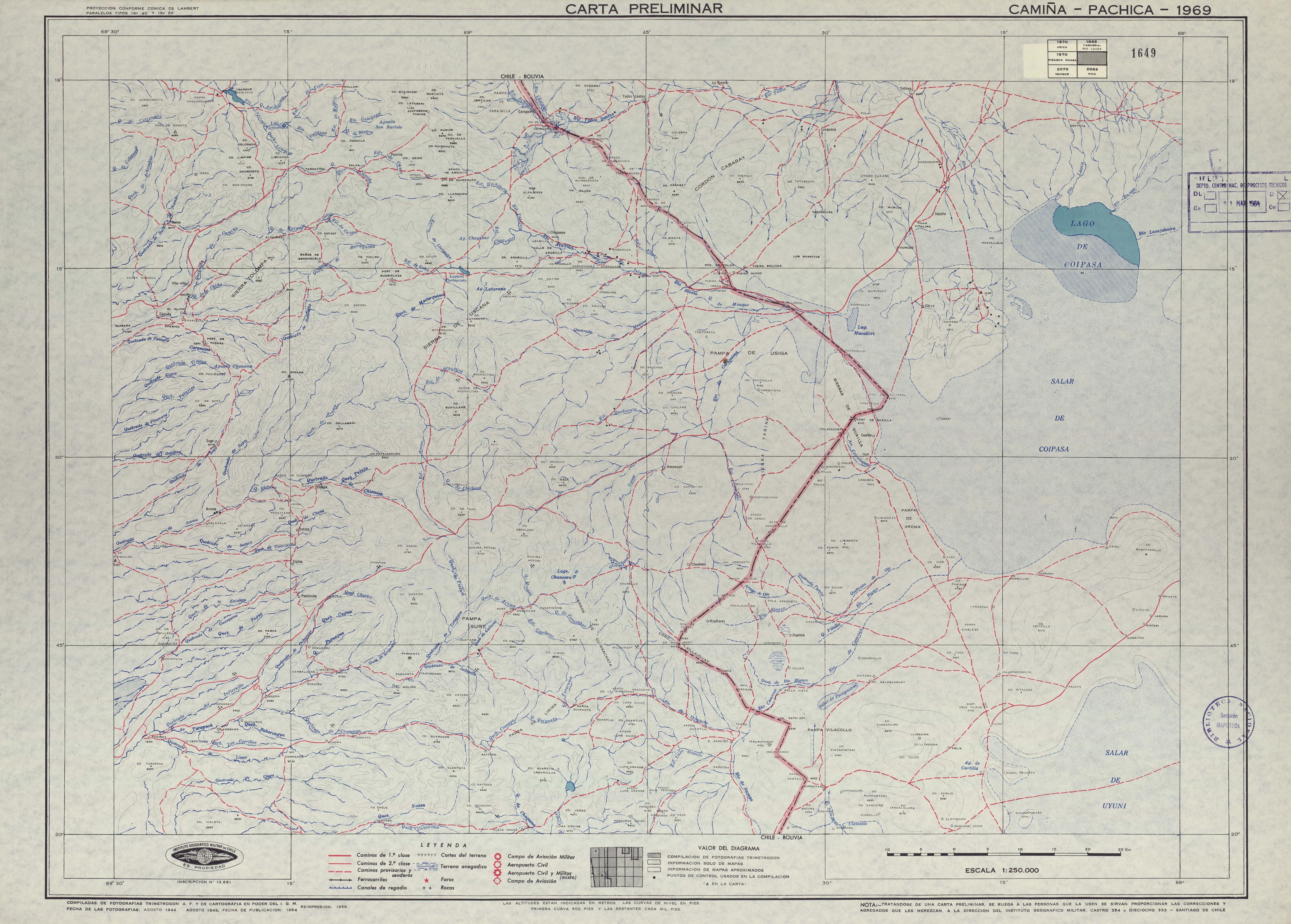
Español: Camiña - Pachica carta preliminar / [material cartográfico] : Instituto Geográfico Militar de Chile. Santiago : Instituto Geográfico Militar de Chile, 1954, (impresión 1958) 1 mapa : color ; 52 x 71 cm, en hoja 55 x 77 cm. . |
| Date | |
| Source | http://www.bibliotecanacionaldigital.gob.cl/bnd/631/w3-article-330120.html |
| Author | Camiña - Pachica carta preliminar / [material cartográfico] : Instituto Geográfico Militar de Chile. Santiago : Instituto Geográfico Militar de Chile, 1954, (impresión 1958) 1 mapa : color ; 52 x 71 cm, en hoja 55 x 77 cm. . |
Licensing edit
This file has fallen into the public domain according to Chilean copyright law (No. 17336 and its amendments). Nevertheless, its author and source must be acknowledged.
See here for the type of material that is in the public domain (patrimonio cultural común / common cultural heritage).
|

|
File history
Click on a date/time to view the file as it appeared at that time.
| Date/Time | Thumbnail | Dimensions | User | Comment | |
|---|---|---|---|---|---|
| current | 08:29, 24 September 2020 |  | 4,468 × 3,200 (2.27 MB) | Juan Villalobos (talk | contribs) | Uploaded a work by Camiña - Pachica carta preliminar / [material cartográfico] : Instituto Geográfico Militar de Chile. Santiago : Instituto Geográfico Militar de Chile, 1954, (impresión 1958) 1 mapa : color ; 52 x 71 cm, en hoja 55 x 77 cm. . from http://www.bibliotecanacionaldigital.gob.cl/bnd/631/w3-article-330120.html with UploadWizard |
You cannot overwrite this file.
File usage on Commons
The following 2 pages use this file:
- IGM-Chile
- File:MP0001299.pdf (file redirect)
File usage on other wikis
The following other wikis use this file:
- Usage on es.wikipedia.org