File:19-12-250-stone.jpg
Size of this preview: 800 × 535 pixels. Other resolutions: 320 × 214 pixels | 640 × 428 pixels | 1,024 × 685 pixels | 1,280 × 856 pixels | 2,048 × 1,369 pixels.
Original file (2,048 × 1,369 pixels, file size: 1.84 MB, MIME type: image/jpeg)
File information
Structured data
Captions
Summary
editDescription19-12-250-stone.jpg |
English: 
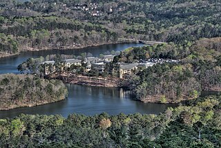
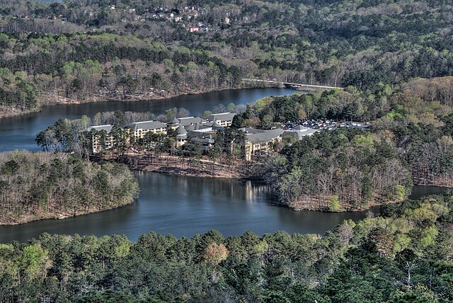
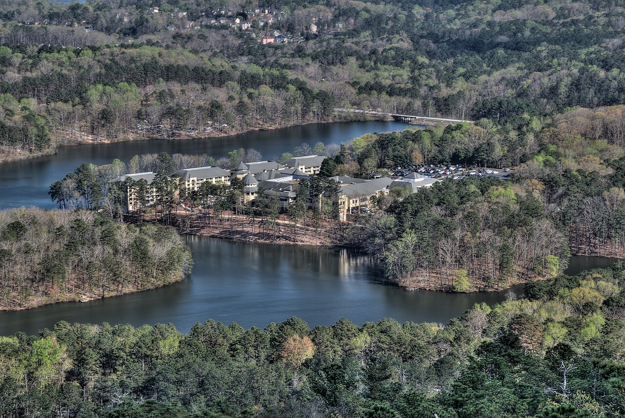
view from summit of Stone Mountain |
Date | |
Source | Own work |
Author | Dsdugan |
Camera location | 33° 48′ 18.73″ N, 84° 08′ 35.08″ W | View this and other nearby images on: OpenStreetMap | 33.805202; -84.143077 |
---|
Licensing
editI, the copyright holder of this work, hereby publish it under the following license:
This file is made available under the Creative Commons CC0 1.0 Universal Public Domain Dedication. | |
The person who associated a work with this deed has dedicated the work to the public domain by waiving all of their rights to the work worldwide under copyright law, including all related and neighboring rights, to the extent allowed by law. You can copy, modify, distribute and perform the work, even for commercial purposes, all without asking permission.
http://creativecommons.org/publicdomain/zero/1.0/deed.enCC0Creative Commons Zero, Public Domain Dedicationfalsefalse |
File history
Click on a date/time to view the file as it appeared at that time.
Date/Time | Thumbnail | Dimensions | User | Comment | |
---|---|---|---|---|---|
current | 00:22, 20 April 2019 | 2,048 × 1,369 (1.84 MB) | Dsdugan (talk | contribs) | User created page with UploadWizard |
You cannot overwrite this file.
File usage on Commons
There are no pages that use this file.
Metadata
This file contains additional information such as Exif metadata which may have been added by the digital camera, scanner, or software program used to create or digitize it. If the file has been modified from its original state, some details such as the timestamp may not fully reflect those of the original file. The timestamp is only as accurate as the clock in the camera, and it may be completely wrong.
Camera manufacturer | NIKON CORPORATION |
---|---|
Camera model | NIKON D5300 |
Exposure time | 1/6 sec (0.16666666666667) |
F-number | f/27 |
ISO speed rating | 100 |
Date and time of data generation | 17:00, 30 March 2019 |
Lens focal length | 75 mm |
Latitude | 33° 48′ 18.73″ N |
Longitude | 84° 8′ 35.08″ W |
Altitude | 481 meters above sea level |
Software used | Photomatix Pro 6.1.2 |
File change date and time | 17:00, 30 March 2019 |
Exposure Program | Aperture priority |
Date and time of digitizing | 17:00, 30 March 2019 |
APEX exposure bias | 0 |
Maximum land aperture | 4.7009944751381 APEX (f/5.1) |
Metering mode | Pattern |
Light source | Unknown |
Flash | Flash did not fire |
DateTime subseconds | 10 |
DateTimeOriginal subseconds | 10 |
DateTimeDigitized subseconds | 10 |
Sensing method | One-chip color area sensor |
File source | Digital still camera |
Scene type | A directly photographed image |
Custom image processing | Normal process |
Exposure mode | Auto exposure |
White balance | Auto white balance |
Digital zoom ratio | 1 |
Focal length in 35 mm film | 112 mm |
Scene capture type | Standard |
Scene control | None |
Contrast | Normal |
Saturation | Normal |
Sharpness | Normal |
Subject distance range | Unknown |
GPS time (atomic clock) | 21:00:42.45 |
Satellites used for measurement | 09 |
Geodetic survey data used | WGS-84 |
GPS date | 30 March 2019 |
GPS tag version | 0.0.3.2 |