File:1924 BERy system map (2).png

Size of this preview: 340 × 599 pixels. Other resolutions: 136 × 240 pixels | 272 × 480 pixels | 436 × 768 pixels | 581 × 1,024 pixels | 1,162 × 2,048 pixels | 3,500 × 6,167 pixels.
Original file (3,500 × 6,167 pixels, file size: 31.76 MB, MIME type: image/png)
Captions
Captions
Add a one-line explanation of what this file represents
Summary edit
| Description |
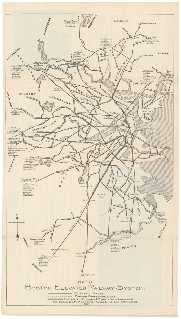
English: 1924 map of the Boston Elevated Railway system |
|||
| Date | ||||
| Source | BERy Guide and Information Brochure, via Ward Maps | |||
| Author | Boston Elevated Railway | |||
| Permission (Reusing this file) |
|

.png&action=edit§ion=1)
File history
Click on a date/time to view the file as it appeared at that time.
| Date/Time | Thumbnail | Dimensions | User | Comment | |
|---|---|---|---|---|---|
| current | 04:28, 12 June 2020 | | 3,500 × 6,167 (31.76 MB) | Pi.1415926535 (talk | contribs) | {{Information |description ={{en|1=1924 map of the Boston Elevated Railway system}} |date =1924 |source =BERy Guide and Information Brochure, via [https://www.wardmaps.com/viewasset.php?aid=21094 Ward Maps] |author =Boston Elevated Railway |permission ={{PD-scan|PD-US-expired}} }} Category:1924 maps of Massachusetts Category:1924 in Boston Category:Maps of the Boston Elevated Railway Category:Tram maps of Boston [[Category:Other images uploaded by... |
You cannot overwrite this file.
File usage on Commons
The following 3 pages use this file:
.png&oldid=746700443)