File:193 SBELAGOLA LAC1.jpg

Size of this preview: 463 × 599 pixels. Other resolutions: 185 × 240 pixels | 371 × 480 pixels | 593 × 768 pixels | 791 × 1,024 pixels | 1,632 × 2,112 pixels.
Original file (1,632 × 2,112 pixels, file size: 472 KB, MIME type: image/jpeg)
Captions
Captions
Add a one-line explanation of what this file represents
Summary edit
| Description |
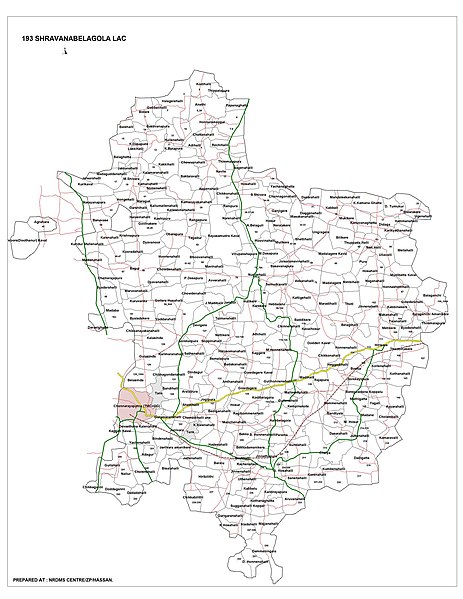
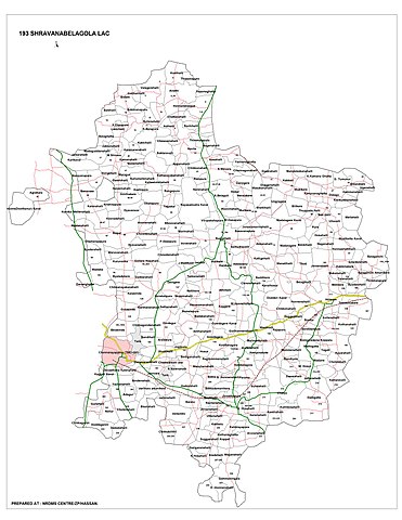
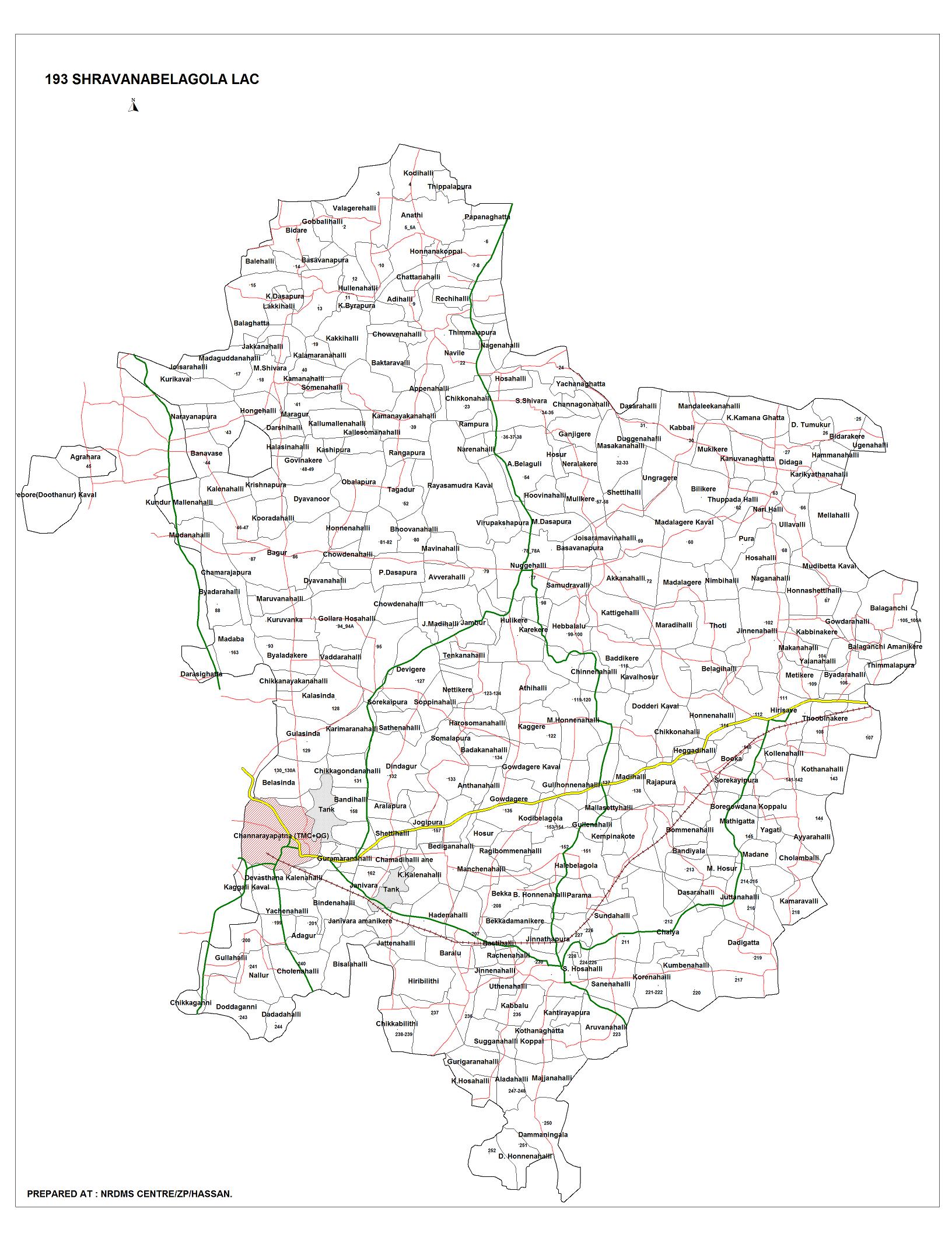
English: Village Map of Shravanabelagola Assembly constituency, Channarayapatna Taluk |
| Date | |
| Source | https://channarayapatna.kar.nic.in/htmls/maps/193_SBELAGOLA_LAC1.jpg |
| Author | Taluk administration, Channarayapatna https://channarayapatna.kar.nic.in/htmls/maps.html |
| Camera location | | View this and other nearby images on: OpenStreetMap |
|---|
Licensing edit

|
This file is a copyrighted work of the Government of India, licensed under the Government Open Data License - India (GODL).
Information on Related Items:
|
 |
|
|

|
This image, which was originally posted in the source indicated above, has not yet been reviewed by an administrator or reviewer to confirm that the above license is valid. See Category:Unreviewed photos of GODL-India for further instructions.
|
File history
Click on a date/time to view the file as it appeared at that time.
| Date/Time | Thumbnail | Dimensions | User | Comment | |
|---|---|---|---|---|---|
| current | 10:50, 21 October 2021 | | 1,632 × 2,112 (472 KB) | Vijethnbharadwaj (talk | contribs) | Uploaded a work by Taluk administration, Channarayapatna https://channarayapatna.kar.nic.in/htmls/maps.html from https://channarayapatna.kar.nic.in/htmls/maps/193_SBELAGOLA_LAC1.jpg with UploadWizard |
You cannot overwrite this file.
File usage on Commons
There are no pages that use this file.
File usage on other wikis
The following other wikis use this file:
- Usage on en.wikipedia.org