File:1945-08-01JapWW2BattlefrontAtlas-arrow.jpg
No higher resolution available.
1945-08-01JapWW2BattlefrontAtlas-arrow.jpg (595 × 591 pixels, file size: 81 KB, MIME type: image/jpeg)
Captions
Captions
Add a one-line explanation of what this file represents
Summary edit
| Description |
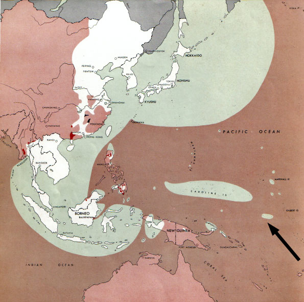
  July 1, 1943 to June 30 1945 To the Secretary of War". (See Cover, Forward and Map details)  |
| Date | |
| Source | Document "Atlas of the World Battle Fronts in Semimonthly Phases to August 15th 1945: Supplement to The Biennial report of the Chief of Staff of the United States Army July 1, 1943 to June 30 1945 To the Secretary of War" |
| Author | Army Map Service |
| Permission (Reusing this file) |
Public Domain: Work of US army |
| Other versions |
|
Category:Nauru in World War II
Licensing edit
This file is a work of a U.S. Army soldier or employee, taken or made as part of that person's official duties. As a work of the U.S. federal government, it is in the public domain in the United States.
|
 |
File history
Click on a date/time to view the file as it appeared at that time.
| Date/Time | Thumbnail | Dimensions | User | Comment | |
|---|---|---|---|---|---|
| current | 07:42, 13 September 2010 | 595 × 591 (81 KB) | Kimdime (talk | contribs) | changing arrow | |
| 13:14, 12 September 2010 | 595 × 812 (117 KB) | Kimdime (talk | contribs) | recentred | ||
| 09:33, 12 September 2010 | 842 × 595 (89 KB) | Kimdime (talk | contribs) | recentred version | ||
| 01:35, 12 September 2010 | 842 × 595 (94 KB) | Kimdime (talk | contribs) | == {{int:filedesc}} == {{Information |Description= thumb|left|75pxthumb|right|75pxMap of the front against Japan as of 1 Aug 1945: This map is taken from the source "Atlas of |
You cannot overwrite this file.
File usage on Commons
There are no pages that use this file.
File usage on other wikis
The following other wikis use this file:
- Usage on de.wikipedia.org
- Usage on fr.wikipedia.org
- Usage on ru.wikipedia.org