File:1947 South China Sea Islands Map.jpg
Size of this preview: 414 × 599 pixels. Other resolutions: 166 × 240 pixels | 332 × 480 pixels | 531 × 768 pixels | 708 × 1,024 pixels | 1,415 × 2,048 pixels | 2,654 × 3,840 pixels.
Original file (2,654 × 3,840 pixels, file size: 950 KB, MIME type: image/jpeg)
Captions
Captions
Add a one-line explanation of what this file represents
Summary edit
| Description |
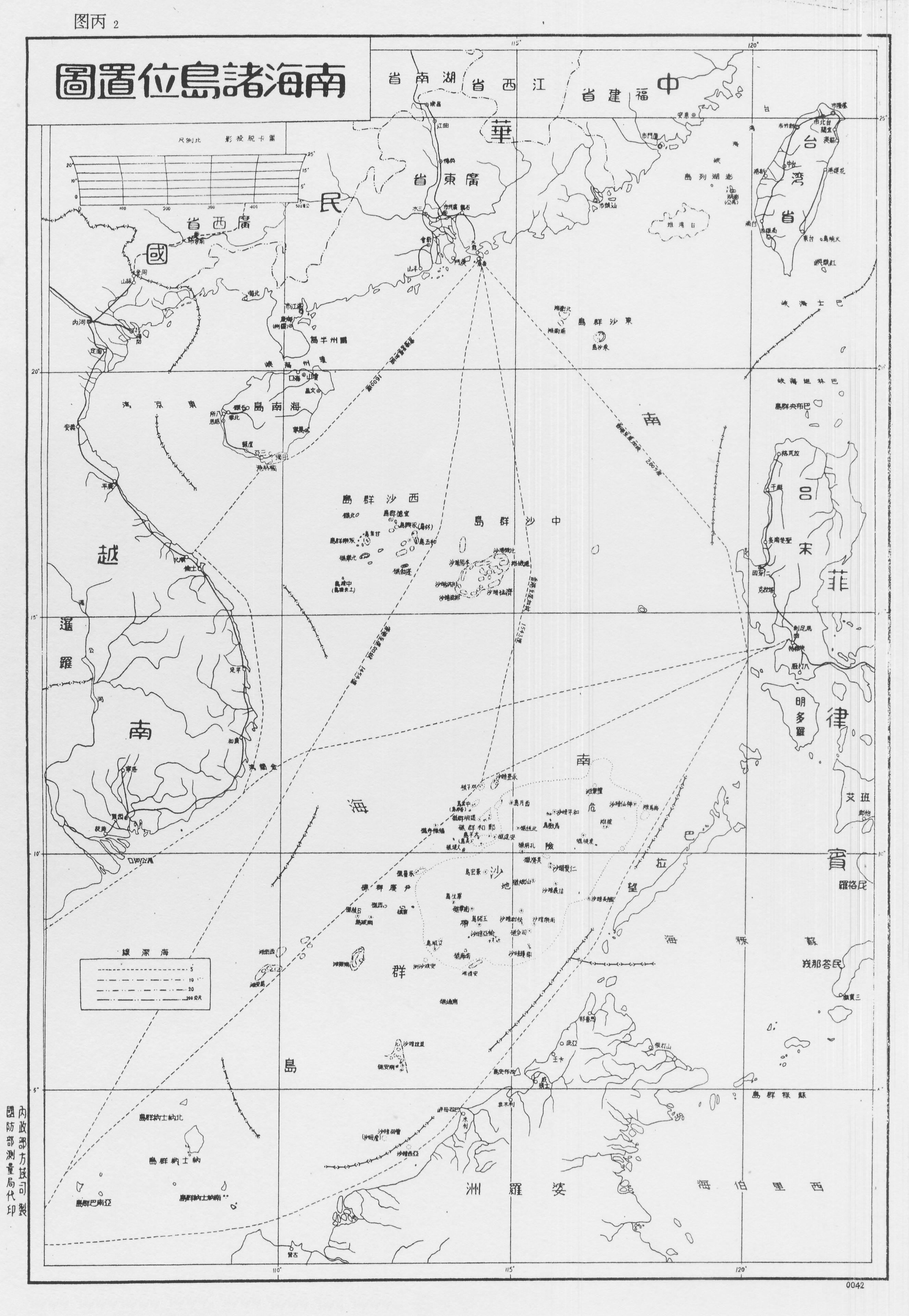
中文:南海諸島位置圖 |
| Date | |
| Source | 1947年4月14日,中華民國內政部召開專門會議,會後出版《南海諸島位置圖》 |
| Author | 中華民國內政部方域司 |
Licensing edit
| This file is made available under the Creative Commons CC0 1.0 Universal Public Domain Dedication. | |
| The person who associated a work with this deed has dedicated the work to the public domain by waiving all of their rights to the work worldwide under copyright law, including all related and neighboring rights, to the extent allowed by law. You can copy, modify, distribute and perform the work, even for commercial purposes, all without asking permission.
|
File history
Click on a date/time to view the file as it appeared at that time.
| Date/Time | Thumbnail | Dimensions | User | Comment | |
|---|---|---|---|---|---|
| current | 14:38, 12 July 2016 | | 2,654 × 3,840 (950 KB) | Liouxiao (talk | contribs) | User created page with UploadWizard |
You cannot overwrite this file.
File usage on Commons
There are no pages that use this file.