File:1972 United States Presidential Election in Mahoning County, Ohio.svg

Size of this PNG preview of this SVG file: 649 × 416 pixels. Other resolutions: 320 × 205 pixels | 640 × 410 pixels | 1,024 × 656 pixels | 1,280 × 820 pixels | 2,560 × 1,641 pixels.
Original file (SVG file, nominally 649 × 416 pixels, file size: 147 KB)
Captions
Captions
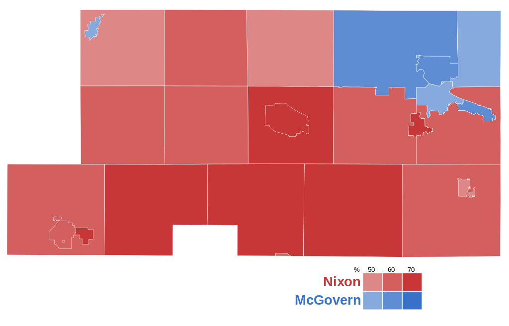
Results shaded by municipality.
Summary
edit
| Description |
English: 1972 United States Presidential Election in Mahoning County, Ohio.
Results from the Mahoning County Board of Elections. |
| Date | |
| Source | Own work |
| Author | MillCreekMaps |
Licensing
edit
I, the copyright holder of this work, hereby publish it under the following license:
This file is licensed under the Creative Commons Attribution-Share Alike 4.0 International license.
- You are free:
- to share – to copy, distribute and transmit the work
- to remix – to adapt the work
- Under the following conditions:
- attribution – You must give appropriate credit, provide a link to the license, and indicate if changes were made. You may do so in any reasonable manner, but not in any way that suggests the licensor endorses you or your use.
- share alike – If you remix, transform, or build upon the material, you must distribute your contributions under the same or compatible license as the original.
File history
Click on a date/time to view the file as it appeared at that time.
| Date/Time | Thumbnail | Dimensions | User | Comment | |
|---|---|---|---|---|---|
| current | 23:00, 5 June 2023 | | 649 × 416 (147 KB) | MillCreekMaps (talk | contribs) | Uploaded own work with UploadWizard |
You cannot overwrite this file.
File usage on Commons
There are no pages that use this file.