File:1983-Canada-Topographic-Map.jpg

Size of this preview: 673 × 600 pixels. Other resolutions: 269 × 240 pixels | 539 × 480 pixels | 862 × 768 pixels | 1,149 × 1,024 pixels | 2,299 × 2,048 pixels | 7,874 × 7,016 pixels.
Original file (7,874 × 7,016 pixels, file size: 13.31 MB, MIME type: image/jpeg)
Captions
Captions
Add a one-line explanation of what this file represents
Summary edit
| Description |
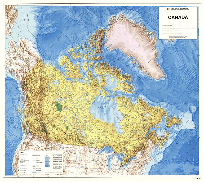
English: Contained within the Atlas of Canada's Reference Map Series, 1961 to 2010, is a map of Canada shows national, provincial and territorial boundaries. Data on the map sheet is restricted to national parks, glaciers, populated places and drainage features. The drainage network corresponds to the ""full drainage"" network used for most National Atlas of Canada, 5th Edition maps. The Canadian land mass is in yellow with shaded relief being used as well. A notable feature is the use of shaded bathymetry. |
| Date | |
| Source | https://open.canada.ca/data/en/dataset/0186fa51-978a-5aba-a6fc-d60aa2aa94da |
| Author | Natural Resources Canada |
Licensing edit
.svg) |
This file is licensed under the Open Government Licence - Canada 2.0. |
|
File history
Click on a date/time to view the file as it appeared at that time.
| Date/Time | Thumbnail | Dimensions | User | Comment | |
|---|---|---|---|---|---|
| current | 23:05, 3 April 2023 | | 7,874 × 7,016 (13.31 MB) | PascalHD (talk | contribs) | Uploaded a work by Natural Resources Canada from https://open.canada.ca/data/en/dataset/0186fa51-978a-5aba-a6fc-d60aa2aa94da with UploadWizard |
You cannot overwrite this file.
File usage on Commons
There are no pages that use this file.