File:1990 Creuzburg PferdsdorferWeg.jpg

Size of this preview: 800 × 471 pixels. Other resolutions: 320 × 188 pixels | 640 × 377 pixels | 1,024 × 603 pixels | 1,280 × 754 pixels | 3,367 × 1,983 pixels.
Original file (3,367 × 1,983 pixels, file size: 2.55 MB, MIME type: image/jpeg)
Captions
Captions
Add a one-line explanation of what this file represents
Summary
edit
| Description |
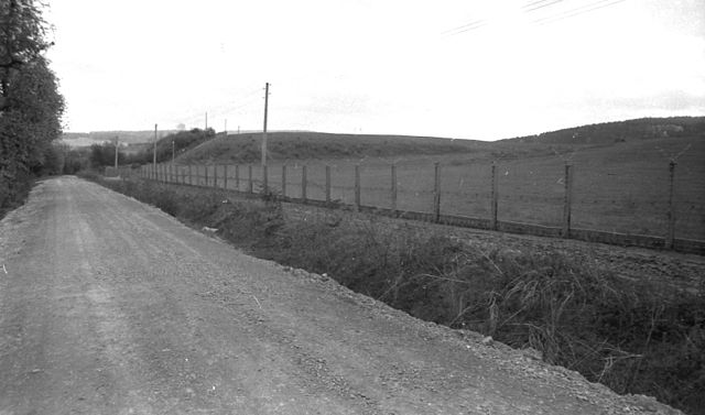
Deutsch: Die nach etwa 25 Jahren Vollsperrung für den öffentlichen Verkehr im Winter 1989/90 provisorisch erneuerte Straße Creuzburg -Pferdsdorf/Werra führte einige Hundert Meter an den ehemaligen Grenzsperranlagen (500-Meter-Steifen) am Iftaer Bach ("die Ifth") entlang. Wenige Wochen später wurde auch dieses Grenzbauwerk beseitigt. |
| Date | Taken in April 1990 |
| Source | Own work |
| Author | Metilsteiner |
Der im Bild gezeigte Abschnitt unweit der Einmündung der Ifta in die Werra gehöhrt heute zum Radwanderweg "Grünes Band" und grenzt links an das (erweiterte) Firmengelände des Sägewerks Pollmeier.
Licensing
edit
I, the copyright holder of this work, hereby publish it under the following license:
This file is licensed under the Creative Commons Attribution 3.0 Unported license.
- You are free:
- to share – to copy, distribute and transmit the work
- to remix – to adapt the work
- Under the following conditions:
- attribution – You must give appropriate credit, provide a link to the license, and indicate if changes were made. You may do so in any reasonable manner, but not in any way that suggests the licensor endorses you or your use.
File history
Click on a date/time to view the file as it appeared at that time.
| Date/Time | Thumbnail | Dimensions | User | Comment | |
|---|---|---|---|---|---|
| current | 20:35, 27 March 2012 | | 3,367 × 1,983 (2.55 MB) | Metilsteiner (talk | contribs) | {{Information |Description ={{de|1=Die nach etwa 25 Jahren Vollsperrung für den öffentlichen Verkehr im Winter 1989/90 provisorisch erneuerte Straße Creuzburg -Pferdsdorf/Werra führte einige Hundert Meter an den ehemaligen Grenzsperranlagen an d... |
You cannot overwrite this file.
File usage on Commons
There are no pages that use this file.
File usage on other wikis
The following other wikis use this file:
- Usage on de.wikipedia.org