File:2002 Curve Fire map.png

Size of this preview: 600 × 600 pixels. Other resolutions: 240 × 240 pixels | 480 × 480 pixels | 768 × 768 pixels | 1,024 × 1,024 pixels | 2,500 × 2,500 pixels.
Original file (2,500 × 2,500 pixels, file size: 10.12 MB, MIME type: image/png)
Captions
Captions
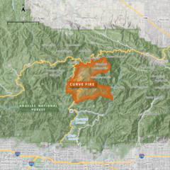
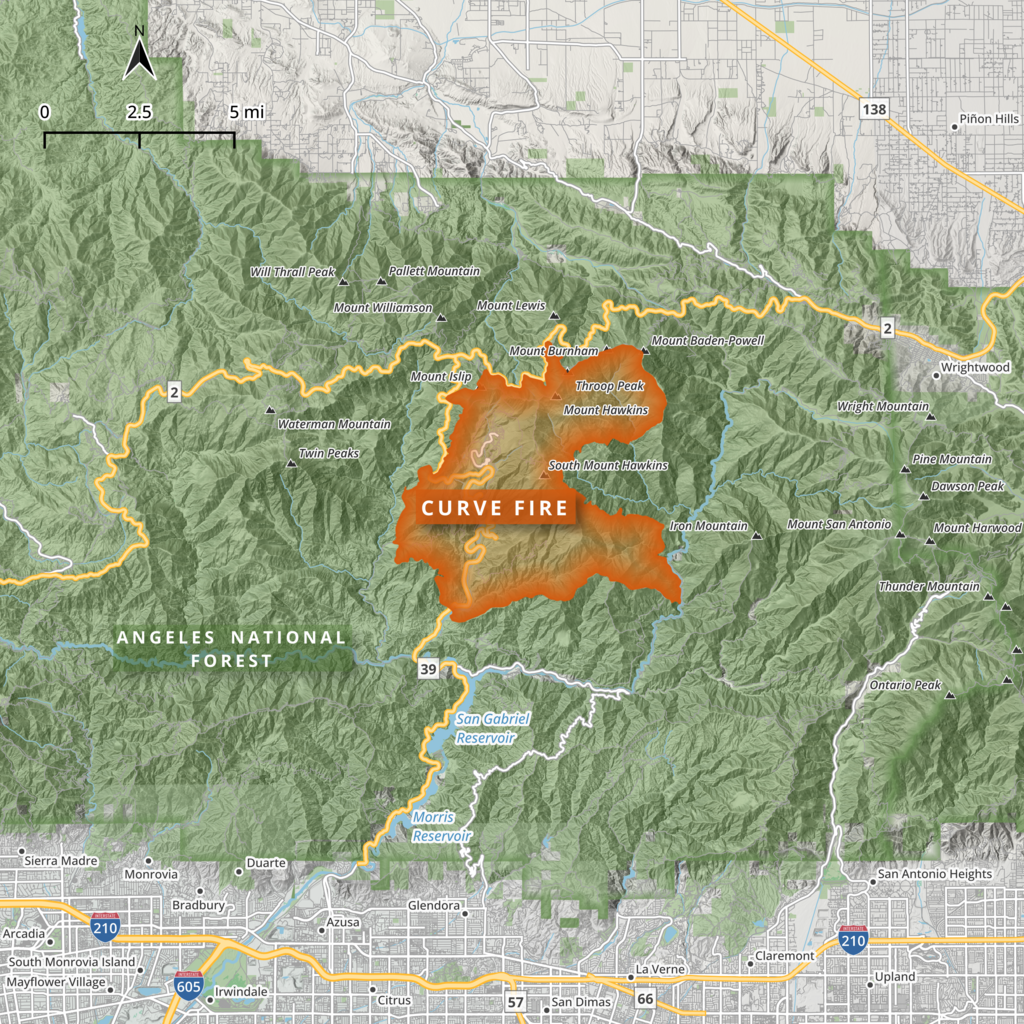
This map shows the footprint of the 2002 Curve Fire, which burned more than 20,000 acres and destroyed more than 70 structures in Los Angeles County, Southern California.
Summary
edit
| Description |
English: This map shows the footprint of the 2002 Curve Fire, which burned more than 20,000 acres and destroyed more than 70 structures in Los Angeles County, Southern California. This map was made in QGIS using data from the California Department of Forestry and Fire Protection (Cal Fire), the National Hydrography Dataset (NHD), OpenStreetMap, and others. |
| Date | |
| Source | Own work |
| Author | Penitentes |
Licensing
edit
I, the copyright holder of this work, hereby publish it under the following license:
This file is licensed under the Creative Commons Attribution-Share Alike 4.0 International license.
- You are free:
- to share – to copy, distribute and transmit the work
- to remix – to adapt the work
- Under the following conditions:
- attribution – You must give appropriate credit, provide a link to the license, and indicate if changes were made. You may do so in any reasonable manner, but not in any way that suggests the licensor endorses you or your use.
- share alike – If you remix, transform, or build upon the material, you must distribute your contributions under the same or compatible license as the original.
File history
Click on a date/time to view the file as it appeared at that time.
| Date/Time | Thumbnail | Dimensions | User | Comment | |
|---|---|---|---|---|---|
| current | 00:28, 10 April 2024 | | 2,500 × 2,500 (10.12 MB) | Penitentes (talk | contribs) | Uploaded own work with UploadWizard |
You cannot overwrite this file.
File usage on Commons
There are no pages that use this file.
File usage on other wikis
The following other wikis use this file:
- Usage on en.wikipedia.org