File:2003 Taitung earthquake intensity map.jpg
Size of this preview: 510 × 600 pixels. Other resolutions: 204 × 240 pixels | 612 × 720 pixels.
Original file (612 × 720 pixels, file size: 104 KB, MIME type: image/jpeg)
Captions
Captions
Add a one-line explanation of what this file represents
Summary
edit
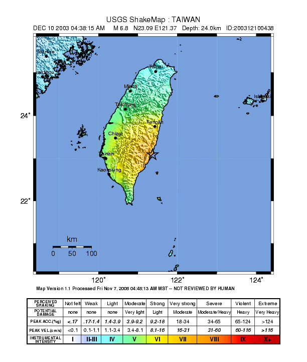
| Description |
中文(臺灣):2003年臺東成功地震震度圖 |
| Date | |
| Source | https://earthquake.usgs.gov/earthquakes/shakemap/atlas/shake/200312100438/ |
| Author | USGS |
Licensing
edit
This image is in the public domain in the United States because it only contains materials that originally came from the United States Geological Survey, an agency of the United States Department of the Interior. For more information, see the official USGS copyright policy.
|
File history
Click on a date/time to view the file as it appeared at that time.
| Date/Time | Thumbnail | Dimensions | User | Comment | |
|---|---|---|---|---|---|
| current | 12:28, 24 August 2016 | | 612 × 720 (104 KB) | Samchtt (talk | contribs) | User created page with UploadWizard |
You cannot overwrite this file.
File usage on Commons
There are no pages that use this file.
File usage on other wikis
The following other wikis use this file:
- Usage on zh.wikipedia.org