File:20071028 Tadami River.jpg

Size of this preview: 800 × 600 pixels. Other resolutions: 320 × 240 pixels | 640 × 480 pixels | 1,024 × 768 pixels | 1,280 × 960 pixels.
Original file (1,280 × 960 pixels, file size: 94 KB, MIME type: image/jpeg)
Captions
Captions
Add a one-line explanation of what this file represents
Summary
edit
| Description |
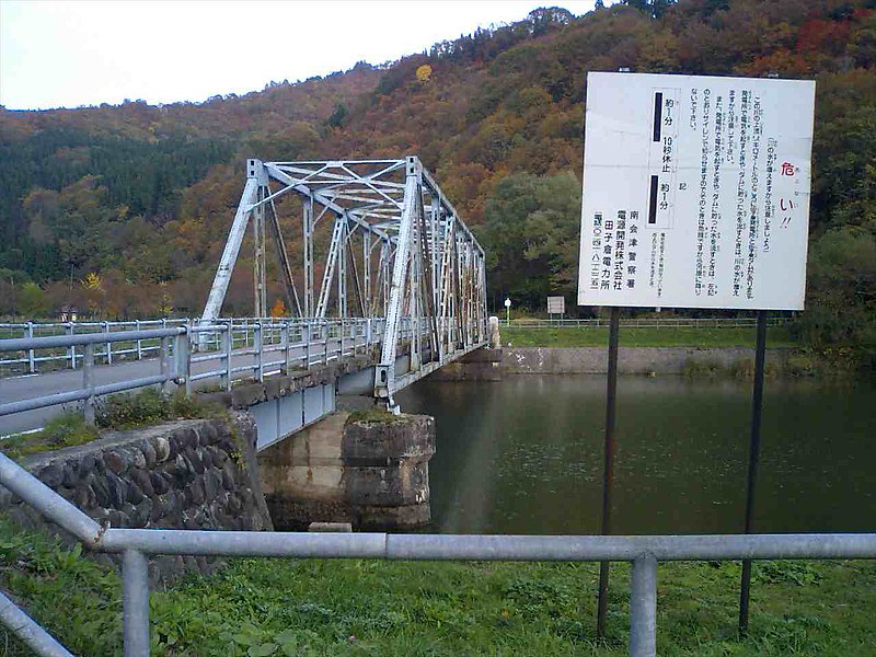
日本語: この画像は2007年10月28日投稿者自身によって福島県南会津郡只見町を流れる只見川そば石伏公園内にて撮影された田子倉ダム(田子倉湖)と只見ダム(只見湖)の間に架かる橋の写真。写真右側に写る看板には「田子倉ダムの放水で水かさが増える際にはサイレンで知らせる」事が書かれている。 |
| Date | Taken on 28 October 2007 16:09:36 |
| Source | Own work |
| Author | Tyutyanya |
| Camera location | | View this and other nearby images on: OpenStreetMap |
|---|
Licensing
edit
I, the copyright holder of this work, hereby publish it under the following license:
This file is licensed under the Creative Commons Attribution-Share Alike 4.0 International license.
- You are free:
- to share – to copy, distribute and transmit the work
- to remix – to adapt the work
- Under the following conditions:
- attribution – You must give appropriate credit, provide a link to the license, and indicate if changes were made. You may do so in any reasonable manner, but not in any way that suggests the licensor endorses you or your use.
- share alike – If you remix, transform, or build upon the material, you must distribute your contributions under the same or compatible license as the original.
File history
Click on a date/time to view the file as it appeared at that time.
| Date/Time | Thumbnail | Dimensions | User | Comment | |
|---|---|---|---|---|---|
| current | 10:51, 30 October 2018 | | 1,280 × 960 (94 KB) | Tyutyanya (talk | contribs) | User created page with UploadWizard |
You cannot overwrite this file.
File usage on Commons
There are no pages that use this file.