File:2010BajaEarthquake.jpg
No higher resolution available.
2010BajaEarthquake.jpg (498 × 458 pixels, file size: 160 KB, MIME type: image/jpeg)
Captions
Captions
Add a one-line explanation of what this file represents
Summary edit
| Description |
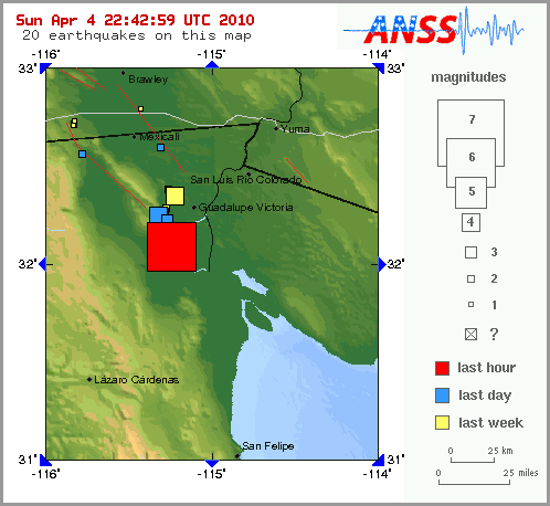
English: Map of 2010 Baja California Earthquake - jpg version |
| Date | |
| Source | www.usgs.gov |
| Author | USGS |
| Other versions | File:2010BajaEarthquake.png |
Licensing edit
This image is in the public domain in the United States because it only contains materials that originally came from the United States Geological Survey, an agency of the United States Department of the Interior. For more information, see the official USGS copyright policy.
|
File history
Click on a date/time to view the file as it appeared at that time.
| Date/Time | Thumbnail | Dimensions | User | Comment | |
|---|---|---|---|---|---|
| current | 23:35, 4 April 2010 | | 498 × 458 (160 KB) | JohnMGarrison (talk | contribs) | {{Information |Description={{en|1=Map of 2010 Baja California Earthquake - jpg version}} |Source=www.usgs.gov |Author=USGS |Date=2010-04-04 |Permission={{pd-usgov}} |other_versions=File:2010BajaEarthquake.png }} Category:Earthquakes in Mexico [[Categ |
You cannot overwrite this file.
File usage on Commons
There are no pages that use this file.