File:2011 Jujuy earthquake intensity.jpg
Size of this preview: 536 × 599 pixels. Other resolutions: 215 × 240 pixels | 612 × 684 pixels.
Original file (612 × 684 pixels, file size: 165 KB, MIME type: image/jpeg)
Captions
Captions
Add a one-line explanation of what this file represents
| Description |
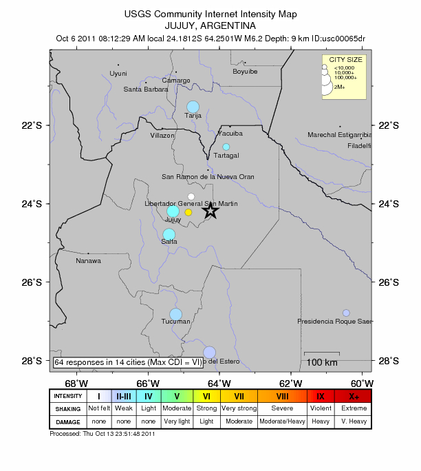
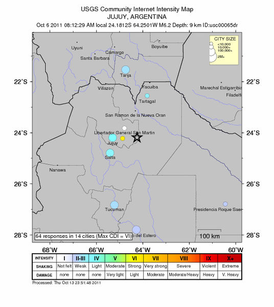
English: Jujuy earthquake intensity map
Español: Mapa de la intensidad del terremoto de Jujuy en 2011. |
|||
| Date | ||||
| Source | https://earthquake.usgs.gov/earthquakes/dyfi/events/us/c00065dr/us/usc00065dr_ciim.jpg | |||
| Author | USGS | |||
| Permission (Reusing this file) |
|
File history
Click on a date/time to view the file as it appeared at that time.
| Date/Time | Thumbnail | Dimensions | User | Comment | |
|---|---|---|---|---|---|
| current | 22:40, 26 October 2011 | | 612 × 684 (165 KB) | Facug (talk | contribs) | {{Information |Description ={{en|1=Jujuy earthquake intensity map}} {{es|1=Mapa de la intensidad del terremoto de Jujuy en 2011.}} |Source =http://earthquake.usgs.gov/earthquakes/dyfi/events/us/c00065dr/us/usc00065dr_ciim.jpg |Author =U |
You cannot overwrite this file.
File usage on Commons
There are no pages that use this file.
File usage on other wikis
The following other wikis use this file:
- Usage on ca.wikipedia.org
- Usage on es.wikipedia.org
- Usage on www.wikidata.org