File:2012-06-09 Max-min Temperature Map NOAA.png

Size of this preview: 800 × 568 pixels. Other resolutions: 320 × 227 pixels | 640 × 454 pixels | 1,000 × 710 pixels.
Original file (1,000 × 710 pixels, file size: 49 KB, MIME type: image/png)
Captions
Captions
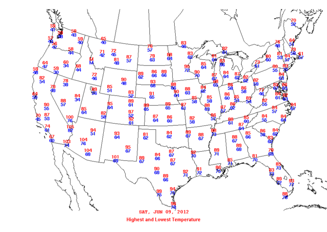
minimum and maximum temperature map
Summary
edit
| Description |
English: A black-and-white minimum-maximum temperature map for 9 June 2012. |
| Date | 9 June 2012 |
| Source | National Centers for Environmental Prediction |
| Author | National Centers for Environmental Prediction |
Licensing
edit
This image is in the public domain because it contains materials that originally came from the U.S. National Oceanic and Atmospheric Administration, taken or made as part of an employee's official duties.
|
File history
Click on a date/time to view the file as it appeared at that time.
| Date/Time | Thumbnail | Dimensions | User | Comment | |
|---|---|---|---|---|---|
| current | 14:05, 15 June 2013 | | 1,000 × 710 (49 KB) | Noaabot (talk | contribs) | == {{int:filedesc}} == {{NOAA-dailywxmap|type=maxmin|date=2012-06-09}} == {{int:license}} == {{PD-USGov-NOAA}} Category:2012 NCEP black and white daily max-min temperature maps Category:NCEP weather maps for June 2012 [[Category:NCEP black and ... |
You cannot overwrite this file.
File usage on Commons
There are no pages that use this file.