File:2012-Top10AHN-Brabantsewal.jpg

Size of this preview: 380 × 599 pixels. Other resolutions: 152 × 240 pixels | 304 × 480 pixels | 487 × 768 pixels | 1,196 × 1,886 pixels.
Original file (1,196 × 1,886 pixels, file size: 925 KB, MIME type: image/jpeg)
Captions
Captions
Add a one-line explanation of what this file represents
Summary
edit
| Description |
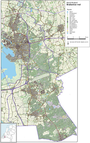
Nederlands: Topografisch beeld van de Brabantse Wal in Noord-Brabant.
Op basis van de GML open geodata van de Top10NL (basisregistratie Topografie, Kadaster 2011), vrijgegeven door Kadaster op 1-1-2012 onder de Creative Commons BY licentie. Gebouwvlakken uit Open Geodata BAG extract (juni 2012). Hoogtekaart op basis van de AHN25 (25x25m, 2005). |
| Date | |
| Source | Own work |
| Author | Janwillemvanaalst |
Licensing
edit
I, the copyright holder of this work, hereby publish it under the following license:
This file is licensed under the Creative Commons Attribution-Share Alike 3.0 Unported license.
- You are free:
- to share – to copy, distribute and transmit the work
- to remix – to adapt the work
- Under the following conditions:
- attribution – You must give appropriate credit, provide a link to the license, and indicate if changes were made. You may do so in any reasonable manner, but not in any way that suggests the licensor endorses you or your use.
- share alike – If you remix, transform, or build upon the material, you must distribute your contributions under the same or compatible license as the original.
File history
Click on a date/time to view the file as it appeared at that time.
| Date/Time | Thumbnail | Dimensions | User | Comment | |
|---|---|---|---|---|---|
| current | 14:03, 30 July 2012 | | 1,196 × 1,886 (925 KB) | Janwillemvanaalst (talk | contribs) |
You cannot overwrite this file.
File usage on Commons
There are no pages that use this file.