File:20120105 exterior Imaret Komotini Western Thrace Greece 1.jpg

Size of this preview: 657 × 600 pixels. Other resolutions: 263 × 240 pixels | 526 × 480 pixels | 842 × 768 pixels | 1,122 × 1,024 pixels | 2,244 × 2,048 pixels | 2,941 × 2,684 pixels.
Original file (2,941 × 2,684 pixels, file size: 6.02 MB, MIME type: image/jpeg)
Captions
Captions
Add a one-line explanation of what this file represents
Summary
edit
| Description |
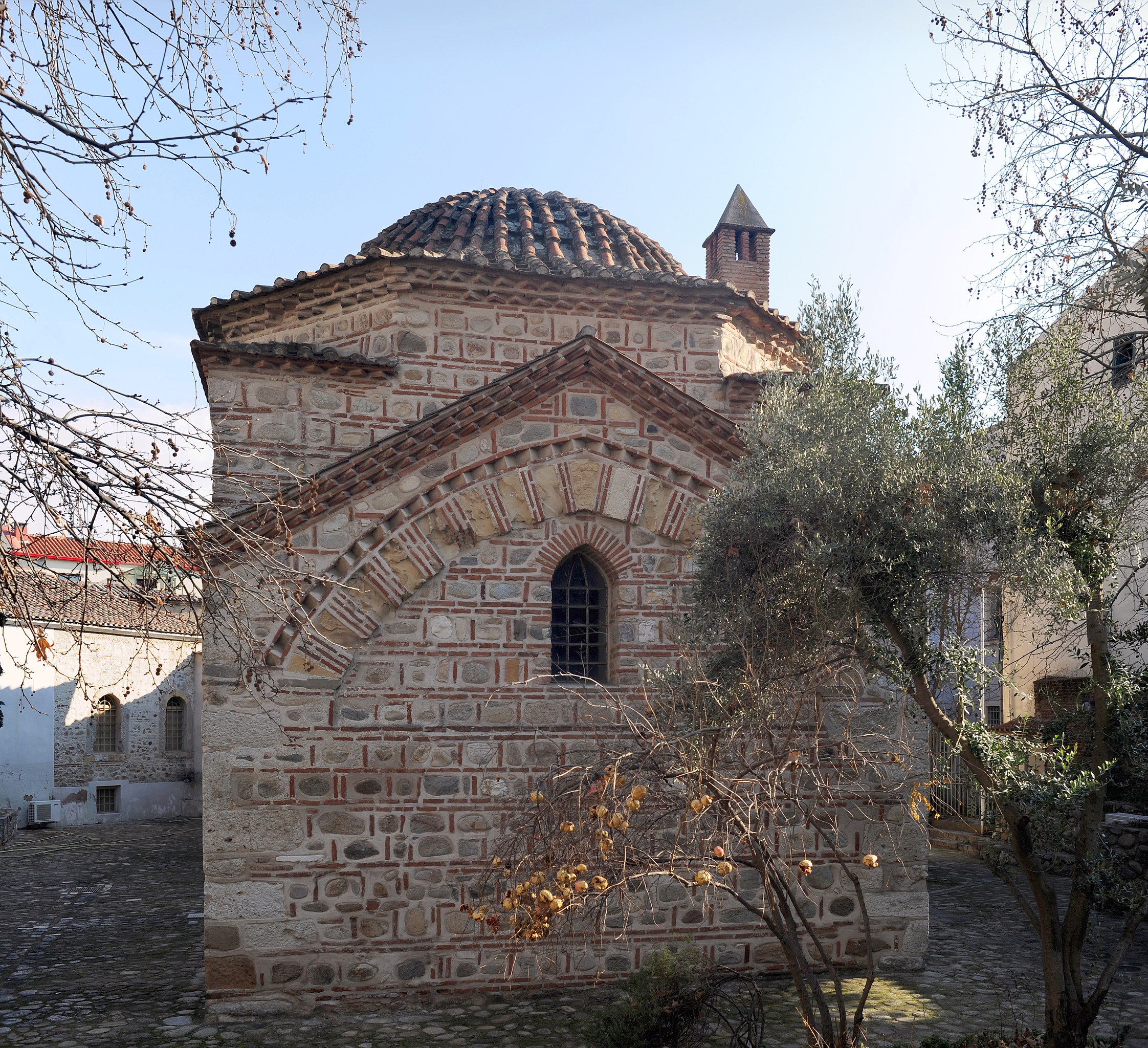
English: Imaret of Komotini (1360-1380) - Gazi Evrenos, Komotini, Rhodope, Western Thrace, Greece.
Ελληνικά: Το Ιμαρέτ της Κομοτηνής - χτισμένο το 1360-1380 από τον Γαζή Αχμέτ Έβρενο, Κομοτηνή ,Ροδόπη, Θράκη, Ελλάδα. |
| Date | |
| Source | Own work |
| Author | User:Ggia |
| Permission (Reusing this file) |
Creative Commons License 3.0 Share-Alike |
| Camera location | | View this and other nearby images on: OpenStreetMap |
|---|
Licensing
edit
This file is licensed under the Creative Commons Attribution-Share Alike 3.0 Unported license.
- You are free:
- to share – to copy, distribute and transmit the work
- to remix – to adapt the work
- Under the following conditions:
- attribution – You must give appropriate credit, provide a link to the license, and indicate if changes were made. You may do so in any reasonable manner, but not in any way that suggests the licensor endorses you or your use.
- share alike – If you remix, transform, or build upon the material, you must distribute your contributions under the same or compatible license as the original.
File history
Click on a date/time to view the file as it appeared at that time.
| Date/Time | Thumbnail | Dimensions | User | Comment | |
|---|---|---|---|---|---|
| current | 18:15, 9 January 2012 | | 2,941 × 2,684 (6.02 MB) | Ggia (talk | contribs) |
You cannot overwrite this file.
File usage on Commons
The following 2 pages use this file:
File usage on other wikis
The following other wikis use this file:
- Usage on ar.wikipedia.org
- Usage on ba.wikipedia.org
- Usage on bg.wikipedia.org
- Usage on da.wikipedia.org
- Usage on de.wikibooks.org
- Usage on el.wikipedia.org
- Usage on en.wikipedia.org
- Usage on it.wikipedia.org
- Usage on mdf.wikipedia.org
- Usage on tr.wikipedia.org
- Usage on www.wikidata.org