File:2012 Density Map.png

Size of this preview: 800 × 514 pixels. Other resolutions: 320 × 205 pixels | 640 × 411 pixels | 1,024 × 658 pixels | 1,280 × 822 pixels | 1,995 × 1,281 pixels.
Original file (1,995 × 1,281 pixels, file size: 119 KB, MIME type: image/png)
Captions
Captions
Add a one-line explanation of what this file represents
Summary
edit
| Description |
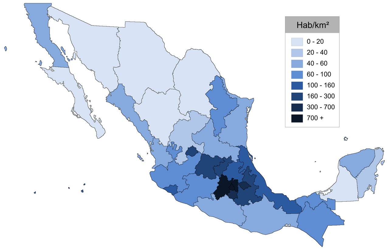
English: Map of Mexico showing population density.
Español: Mapa de México que muestra la densidad de población.
Deutsch: Karte von Mexiko zeigt Bevölkerungsdichte.
Français : Carte du Mexique montrant la densité de population.
Italiano: Mappa di Messico che mostra densità di popolazione.
Português: Mapa da México mostrando densidade de população.
Română: Harta Mexic arată densitatea populației.
Русский: Карта Мексики показывает плотность населения. |
||
| Date | |||
| Source | Own work | ||
| Author | AlexR.L. | ||
| Permission (Reusing this file) |
I, the copyright holder of this work, hereby publish it under the following licenses: This file is licensed under the Creative Commons Attribution-Share Alike 3.0 Unported license.
You may select the license of your choice. |
Licensing
edit
I, the copyright holder of this work, hereby publish it under the following licenses:
This file is licensed under the Creative Commons Attribution-Share Alike 3.0 Unported license.
- You are free:
- to share – to copy, distribute and transmit the work
- to remix – to adapt the work
- Under the following conditions:
- attribution – You must give appropriate credit, provide a link to the license, and indicate if changes were made. You may do so in any reasonable manner, but not in any way that suggests the licensor endorses you or your use.
- share alike – If you remix, transform, or build upon the material, you must distribute your contributions under the same or compatible license as the original.

|
Permission is granted to copy, distribute and/or modify this document under the terms of the GNU Free Documentation License, Version 1.2 or any later version published by the Free Software Foundation; with no Invariant Sections, no Front-Cover Texts, and no Back-Cover Texts. A copy of the license is included in the section entitled GNU Free Documentation License. |
You may select the license of your choice.
File history
Click on a date/time to view the file as it appeared at that time.
| Date/Time | Thumbnail | Dimensions | User | Comment | |
|---|---|---|---|---|---|
| current | 06:15, 3 February 2013 | | 1,995 × 1,281 (119 KB) | AlexR.L. (talk | contribs) | {{Information |Description ={{en|1=Map of Mexico showing population density.}} {{es|1=Mapa de México que muestra la densidad de población.}} {{de|1=Karte von Mexiko zeigt Bevölkerungsdichte.}} {{fr|1=Carte du Mexique montrant la densité de popul... |
You cannot overwrite this file.
File usage on Commons
There are no pages that use this file.
File usage on other wikis
The following other wikis use this file:
- Usage on en.wikipedia.org