File:2014 Borneo Luyten-De-Hauwere-Batang-Ai-Red-Trail-Map.jpg

Size of this preview: 800 × 532 pixels. Other resolutions: 320 × 213 pixels | 640 × 426 pixels | 1,024 × 681 pixels | 1,280 × 851 pixels | 3,008 × 2,000 pixels.
Original file (3,008 × 2,000 pixels, file size: 2.49 MB, MIME type: image/jpeg)
Captions
Captions
Add a one-line explanation of what this file represents
Summary
edit
| Photographer |
Denis Luyten |
| Description |
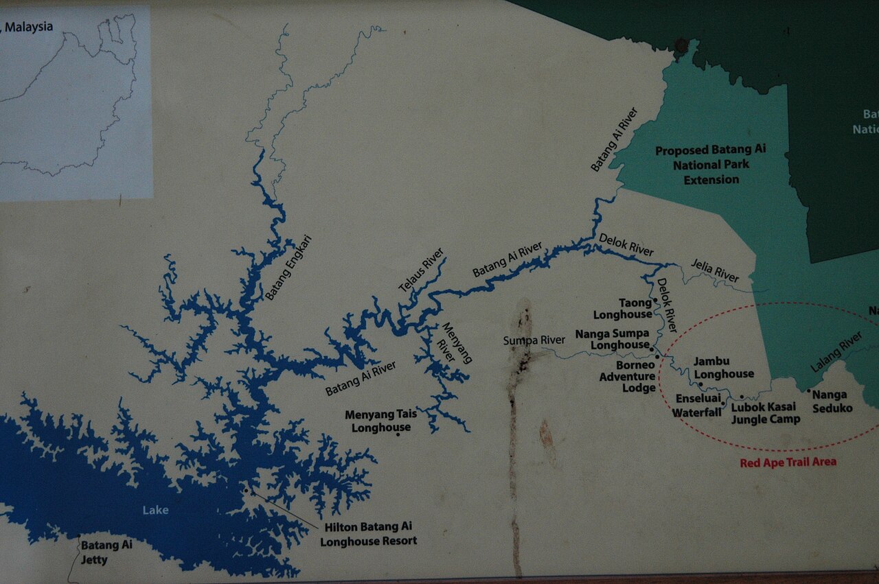
Detailed local map depicting the Red Ape Trail in Batang Ai national park |
| Depicted place | Borneo |
| Date | 11 June 2014, 06:07 |
| Source | Self-photographed |
Licensing
edit
| This work has been released into the public domain by its author, Denis and Chris Luyten-De Hauwere. This applies worldwide. In some countries this may not be legally possible; if so: Denis and Chris Luyten-De Hauwere grants anyone the right to use this work for any purpose, without any conditions, unless such conditions are required by law.
|
File history
Click on a date/time to view the file as it appeared at that time.
| Date/Time | Thumbnail | Dimensions | User | Comment | |
|---|---|---|---|---|---|
| current | 22:04, 6 February 2019 | | 3,008 × 2,000 (2.49 MB) | Bluyten (talk | contribs) | pattypan 18.02 |
You cannot overwrite this file.
File usage on Commons
The following page uses this file: