File:2017-08-24 Medieval bridge near Paderne Castle.JPG

Size of this preview: 800 × 600 pixels. Other resolutions: 320 × 240 pixels | 640 × 480 pixels | 1,024 × 768 pixels | 1,280 × 960 pixels | 2,560 × 1,920 pixels | 4,608 × 3,456 pixels.
Original file (4,608 × 3,456 pixels, file size: 6.08 MB, MIME type: image/jpeg)
Captions
Captions
Add a one-line explanation of what this file represents
| Description |
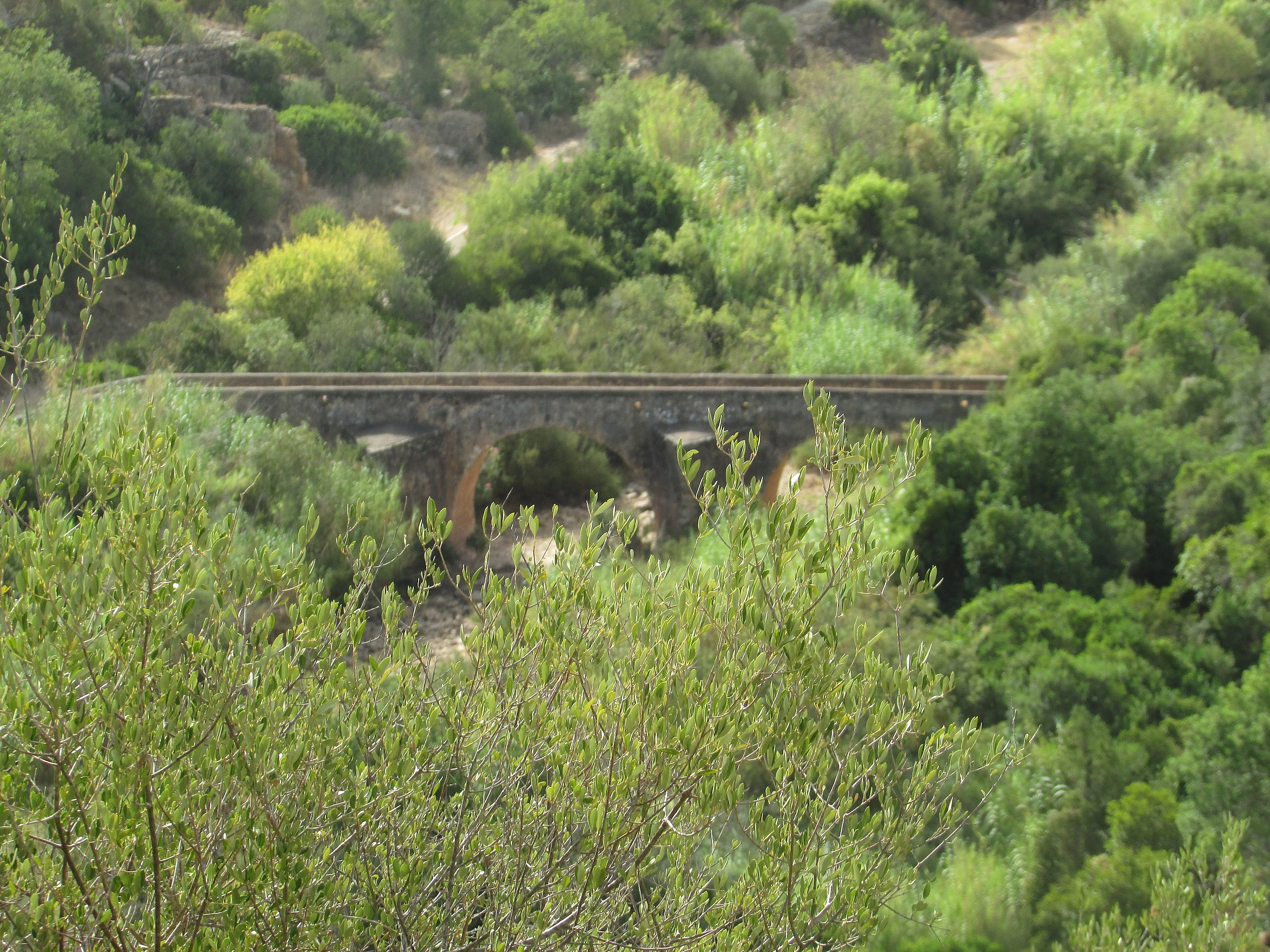
English: A view of the old Medieval bridge of Paderne (Also known as the Roman Bridge) which crosses the Quarteira River close to Paderne castle, Paderne, Algarve, Portugal. The bridge was probably built to serve the castle. The present bridge is built on the pilings of a bridge originally by the Romans to carry the Roman road known as the Via Lusitanorum over river Quarteira. Above the central arch of the bridge there is an inscription that refers the year 1711, probably relating to the year when some works of transformation for consolidation of the structure and recuperation of the walls took place. The Bridge is constructed with three round arches lying on two strong piers. |
|
| Date | ||
| Source | Own work | |
| Author |
This file is licensed under the Creative Commons Attribution-Share Alike 4.0 International license.
|

| Camera location | | View this and other nearby images on: OpenStreetMap |
|---|
| Object location | | View this and other nearby images on: OpenStreetMap |
|---|

|
The copyright holder of this file, Kolforn (Wikimedia), allows anyone to use it for any purpose, provided that the copyright holder is properly attributed. Redistribution, derivative work, commercial use, and all other use is permitted. |
Attribution:
Kolforn (Wikimedia)
|
File history
Click on a date/time to view the file as it appeared at that time.
| Date/Time | Thumbnail | Dimensions | User | Comment | |
|---|---|---|---|---|---|
| current | 14:17, 24 August 2017 | | 4,608 × 3,456 (6.08 MB) | Kolforn (talk | contribs) | {{Information |Description={{en|A view of the old Medieval bridge of Paderne (Also known as the Roman Bridge) which crosses the Quarteira River close to Paderne castle, Paderne, Algarve, Portugal. The bridge was probably built to serve the castle. The... |
You cannot overwrite this file.
File usage on Commons
There are no pages that use this file.